It is time to decorate your personal space, but all you can think about is relaxing at the lake. Lake life is incredible, with the cool breeze coming off the water or the activities you love to participate in.
Embrace your lake persona and decorate with lake art. Beautiful wood maps paired with meaningful keepsakes from your time at the lake can be the basis for building a décor scheme. Find lakes of wood to display and envision yourself on the shore.
Why Use Lake Art in Your Home Décor?

Lake art is a wonderful design choice, as it can remind you of your favorite vacation or a place you’d like to cross off your bucket list while pulling together a trendy nautical aesthetic. Whether decorating a lake house, office, or your inland home, you can honor your favorite waterfront locale when you proudly display your nautical wood map.
In addition to sentimental items, like photos or souvenirs from your beloved lake, find nautical-themed décor items for a cohesive look.
Creating Lakes of Wood
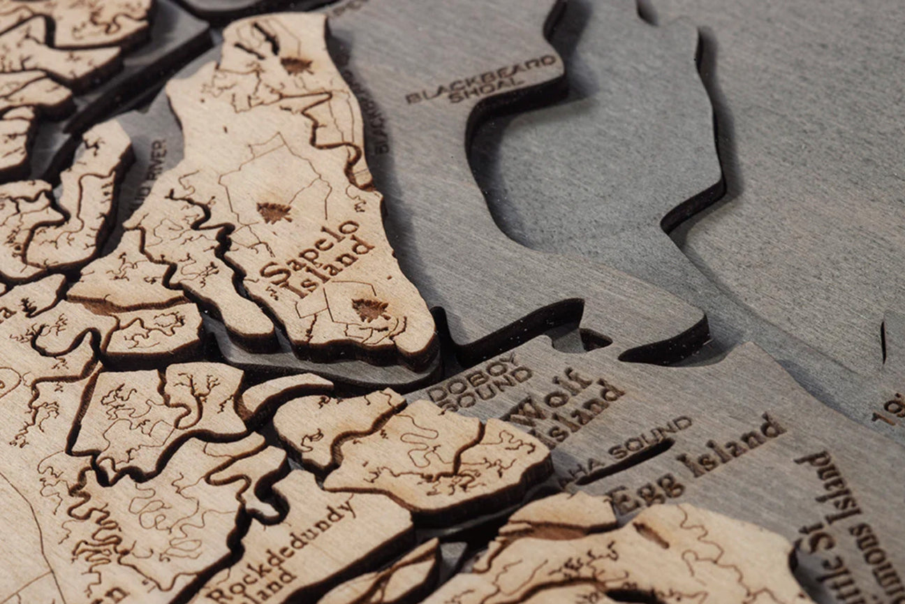
Wood maps are expertly crafted to showcase a lake’s natural beauty. Artists feature everything from the shores to the water depths in these stunning lakes of wood, taking measurements from bathymetric charts to get an accurate scale and create some incredible visual interest.
Those bathymetric dimensions are transferred to a laser cutter, which is then used to cut precise pieces of birch into layers that will accurately depict the growing depth of the lake in your lake art. When the pieces are assembled and glued together, the area on the map representing water is hand-stained to stand out.
Before the lakes of wood are finished, the artist laser-engraves key points of interest, roadways, and landmarks on the map so you’ll be able to spot every detail of the region. Wood maps are protected by a layer of acrylic and fitted with a custom frame so you can easily hang yours and cherish it for years to come.
5 Types of Lake Wood Maps

What is the best way to display your wood maps? That depends entirely on what kind of lake art you’re looking for. Some of our favorite lakes of wood include:
- 3D Wood Maps
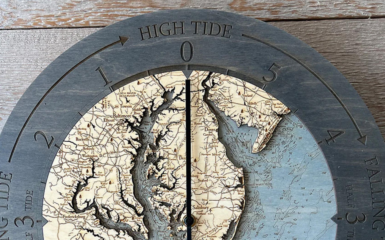
- Wall Clocks
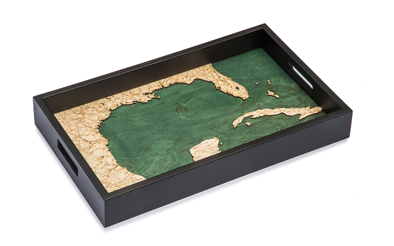
- Serving Trays
- Cribbage Boards
- Cork Maps
The Perfect Lakes for Your Wood Map
Choosing the suitable lakes of wood for your space is as easy as deciding on your lake and how you want it displayed. Do you want to serve your favorite snacks on an elegant serving tray, or do you want to gaze upon your lake art displayed on your wall, or while you play cribbage? The choice is yours, and there is no wrong choice. Some of our favorite lakes to depict in high-quality birch are:
The Great Lakes

One of the most recognizable groups of lakes in North America is the Great Lakes. These are the largest freshwater lakes on Earth. This unique freshwater system spans eight U.S. states and two Canadian provinces, meaning you’re bound to find a Great Lakes destination you love.
Wood maps of the Great Lakes include important landmarks such as Chicago, Milwaukee, and Niagara Falls. In addition to the 3D maps available, find Great Lakes of wood in our Fire & Birch series of wood maps.
When celebrating the Great Lakes, consider displaying a map of all five lakes accompanied by lake art of your favorite or one that holds sentimental value for you.
Lake Superior
Lake Superior is not just the largest of the Great Lakes; it is also the largest freshwater lake in the world. It is just above Michigan’s upper peninsula, with Canada on the other side. The lake has over 30 lighthouses around its shores. It is also the site of mysterious shipwrecks.
When considering lakes of wood for your home, it’s hard to pass up wood maps of Lake Superior. These maps include landmarks such as Provincial Park, Superior National Forest, and Thunder Bay. This piece of lake art will invoke conversation so you can impress with your knowledge of Lake Superior.
Lake Huron

Lake Huron is the second largest of the Great Lakes, boarding the eastern outline of Michigan’s “mitten.” Position yourself along the 93 miles of shoreline on top of the Michigan thumb to catch a sunrise, and include those photos in your lake art display.
Fort Gratiot Lighthouse, the oldest operating lighthouse in Michigan, was built in 1814 to guard the area where the St. Clair River and Lake Huron meet. Visitors can tour the lighthouse now, taking the 94 iron stairs to the top. Wood maps of Lake Huron include Saginaw Bay, St. Joseph Island, and Sault Ste. Marie, making it a perfect piece for your lakes of wood collection.
Lake Michigan

Lake Michigan, the third largest of the Great Lakes, is the only Great Lake held completely inside the United States. It is also the world’s largest lake by area that is entirely inside one country, making it a notable centerpiece for your lake art decorations.
The word Michigan likely comes from the Native American word michi-gami, which means great water. It is easy to see why the Hopewell Native Americans who lived along the shore of Lake Michigan came up with this name.
Display your Lake Michigan map on the wall or play cribbage on a board featuring the popular lake. For your Great Lakes of wood display, the wood maps of Lake Michigan include Beaver Island, Egg Harbor, and Grand Rapids.
Lake Erie
Lake Erie is the fourth largest and most shallow of the Great Lakes, but it is still one of the most popular vacation spots in the region. The lake is ideal for both relaxation and water sports, and it famously serves as the primary outflow for Niagara Falls.
Lake art of Lake Erie showcases Ann Arbor, Cedar Point, and Presque Isle. As the shallowest of the Great Lakes, it would be a part of a beautiful display of lakes of wood, showcasing the wood maps’ attention to detail.
Lake Ontario

Of all the Great Lakes, Lake Ontario is the smallest. It is the only one of the Great Lakes that does not border Michigan, sharing a border instead with New York to the south and east and the Canadian province of Ontario to the north, west, and southwest. The wood maps of Lake Ontario include Niagara Falls, Amherst Island, and the St. Lawrence River, making it a gorgeous addition to your lake art.
Even though it is the smallest of the five, Lake Ontario holds four times the water volume of Lake Erie, with a maximum depth of 802 feet. These two lakes of wood will show the difference in depth when placed next to each other.
Arbutus Lake, Michigan
But what about the other lakes in Michigan? Arbutus Lake is a striking reservoir in the Forest Lakes area of Grand Traverse County. It is made of five lakes chained together by narrow channels, making it another stunning lakes of wood display.
With campgrounds, boat launches, and a YMCA camp that hosts hundreds of campers each summer, Arbutus Lake is a nostalgic spot for many. What better way to remember your summers at camp than with a piece of art?
The unique outline of this five-in-one lake makes beautiful lake art. Be sure to check out the map of Arbutus Lake to add to your lakes of wood.
New York’s Finger Lakes

New York’s Finger Lakes region is a popular destination for vacationers just south of Lake Ontario, with wineries and lake life in the same area. The lakes of this region are long and thin, giving the area its unique name.
The region includes 11 primary lakes:
- Canadice Lake
- Canandaigua Lake
- Cayuga Lake
- Conesus Lake
- Hemlock Lake
- Honeoye Lake
- Keuka Lake
- Otisco Lake
- Owasco Lake
- Seneca Lake
- Skaneateles Lake
These lakes of wood are beautiful on their own or displayed in a group, including your favorite lake and a map of all the Finger Lakes. Pay tribute to this region in your home or lake house with stunning lake art.
Lake Placid
Also in northern New York, Lake Placid is a beautiful, year-round attraction. Found in the Adirondack Mountains, Lake Placid appeals to hikers, wildlife lovers, and water sports fanatics.
The lake is divided into two areas — East Lake and West Lake — and has three primary islands:
- Buck Island
- Moose Island
- Hawk Island
Lake Placid was home to the 1980 Winter Olympics, where the U.S. men’s Olympic hockey team defeated the Soviet Union. This game has been dubbed “Miracle on Ice” and has taken a life of its own in legend and feature film.
The Lake Placid wood maps feature Whiteface, Mirror Lake, and McKenzie Mountain Wilderness Area. The lake art of Lake Placid would make a stunning centerpiece for a gallery wall of winter sports memorabilia.
Lake Travis

Just northwest of Austin, Texas, lies the stunning Lake Travis. Known as the “crown jewel” of the Central Texas Highland Lake, Lake Travis is Texas’ most-visited freshwater recreational destination.
Lake Travis is known for its vibrant blue color, which makes a wood chart of this lake even more accurate. This coloring is caused by the limestone beds and the surrounding limestone cliffs.
Lake Travis has 271 miles of shoreline, making it a fun place to visit and a beautiful addition to your lakes of wood collection. The lake art of Lake Travis includes Hippie Hollow Park, Hudson Bend, and Marshall Ford.
Moosehead Lake
In northwestern Maine, Moosehead Lake is the largest mountain lake in the eastern United States. The Longfellow Mountains surround Moosehead Lake, and the reservoir contains more than 80 islands.
Moosehead Lake is three hours north of Portland. As the name suggests, visiting Moosehead Lake may give you a great chance to see a moose in the wild. The area is also one of North America’s heaviest black bear concentrations per acre.
The lake art of Moosehead Lake includes Farm Island, North Bay, and Sugar Island. With its details of both the lake and the region around it, Moosehead Lake wood charts make for one more example of stunning wood maps.
Lake of the Ozarks

Snaking through the heart of Missouri, the Lake of the Ozarks is a beautiful sight. With more than 1,100 miles of shoreline, the Lake of the Ozarks has more shoreline than the coast of California. One of the world’s largest manufactured lakes, it was created with the construction of the Bagnell Dam on the Osage River.
The Lake of the Ozarks is a specifically striking addition to your lakes of wood collection because of the shape of this slender lake. The wood maps include Sunrise Beach, Porter Mill Bend, and Old Linn Creek — a ghost town covered by water when the dam was built.
Sebago Lake
Sebago Lake is the second-largest lake in Maine and is more than 300 feet deep in spots. This depth is achieved by the Eel Weir Dam, built in 1866. The Sebago Lake State Park sits on the lake’s northeast corner and has lakeside camping, boat launches, and picnic areas.
When it comes to lakes of wood, Sebago Lake is a beautiful addition to your lake art with its incredible depth and detail. Points of interest included on the map are Frye Island, Steep Falls Wildlife Management Area, and South Naples.
Big Bear Lake

Big Bear Lake in southern California is a destination for all seasons. It is located within San Bernardino National Forest, so it’s easy to visit from Phoenix and Las Vegas. This region has mountain vistas and 22 miles of shoreline, making it a travel destination for many.
Hang your California lake art to remember your vacation to Big Bear Lake. A wood map of the basin features the lake and the surrounding roadways, including pinpoints of Big Bear Solar Observatory, Big Bear City, and Big Bear Dam.
Any lake can make a beautiful wood map. Between the intricate details and the displayed water depth, these lakes of wood are the perfect addition to any lake art décor scheme. Find your favorite lake and display it with pride to complete your nautical home décor look.