WoodChart
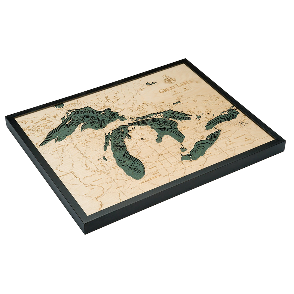
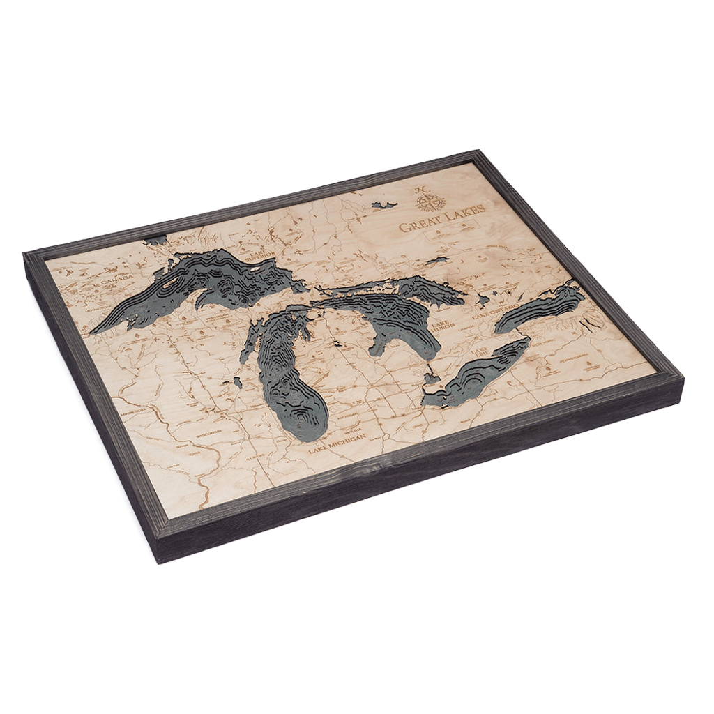
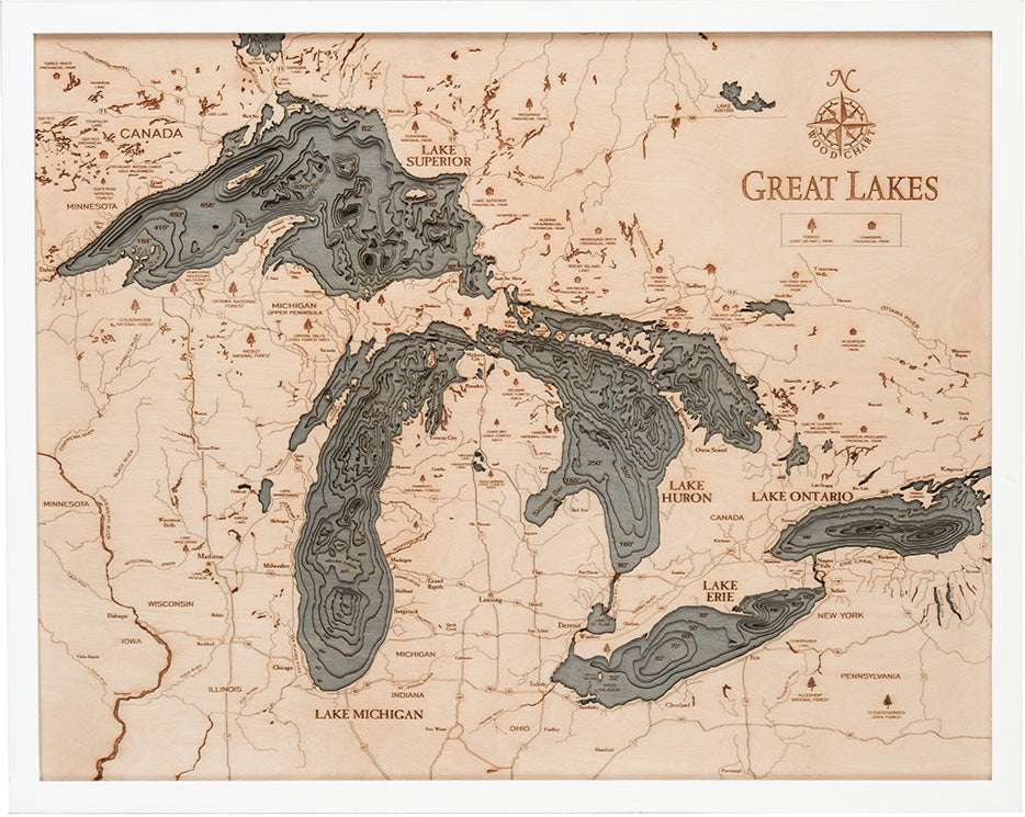
Great Lakes 3-D Nautical Wood Chart, Large, 24.5" x 31"
- Regular price
- $332.00
- Sale price
- $332.00
- Regular price
If you’re looking for some of the most beautiful shoreline landscapes in the country, look no further than Michigan’s Great Lakes. With more than 35,000 islands to explore across the lakes, you’ll find fishing, camping, hiking, boating, and more in abundance.
The Great Lakes are an interconnected group of freshwater lakes that connect the Atlantic Ocean to the Saint Lawrence River. They are the largest freshwater lakes on Earth, with roughly 21% of the world’s surface freshwater by volume. The area features many ocean-like qualities, earning it the nickname the inland seas.
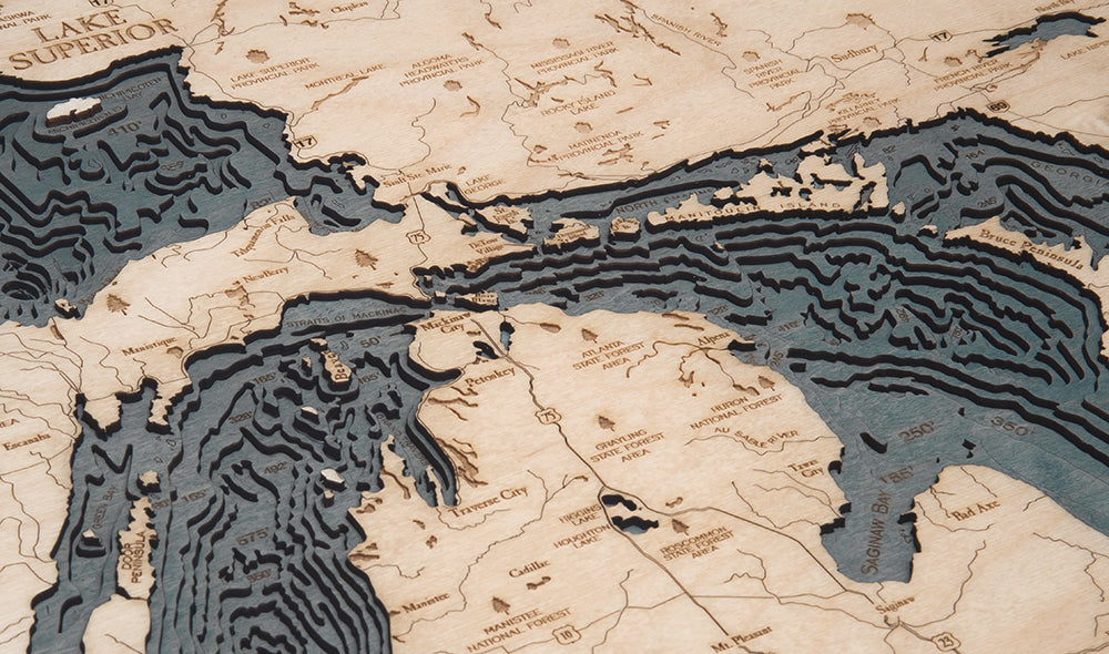
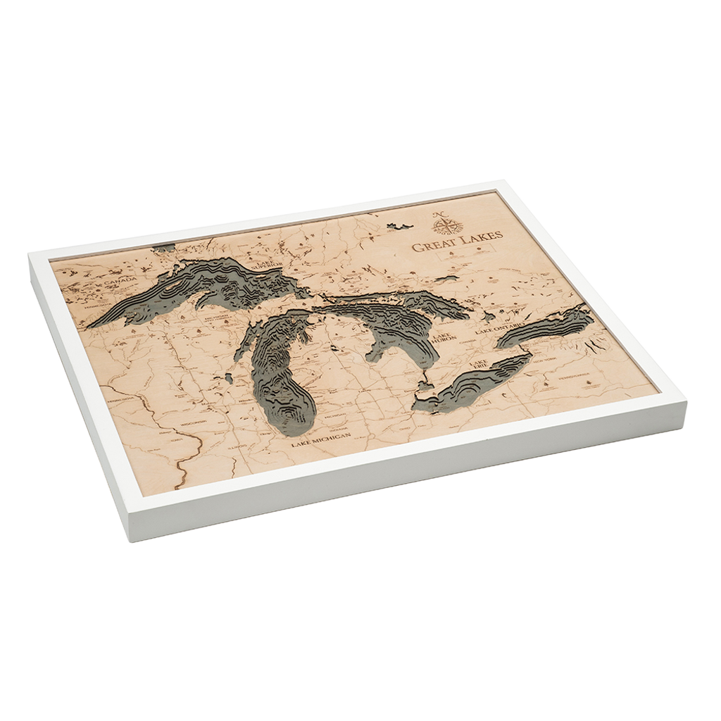
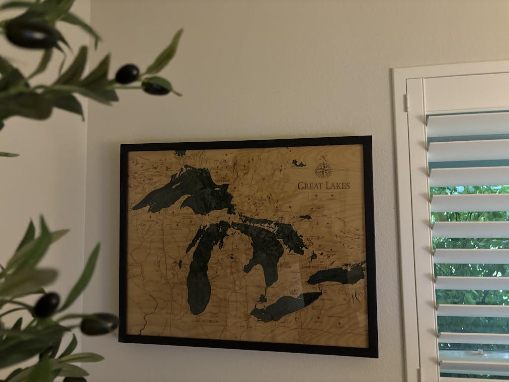
Our Great Lakes 3D Nautical Wood Chart showcases the beauty of the floor of the lakes and the surrounding area. An artist laser cuts pieces of high-quality birch and expertly glues them together, creating the incredible depth and dimension our lake art is known for. Each topographical map features hand-stained water accents with laser-etched points of interest and a custom size solid wood frame.
Show off your love of the Great Lakes with this incredible topographical wood lake.
Points of Interest on Great Lakes Map:
Chicago, Milwaukee, Detroit, Cleveland, Niagara Falls, Lake Michigan, Lake Superior, Lake Huron, Lake Erie, and Lake Ontario
- Made of High-Grade Birch
- Solid wood frame made to fit
- Laser-cut depth
- Engraved names and locations
- Acrylic glass protection
- Arrives ready to hang
- Dark Brown Frame, Greenish Blue Water
- Rustic Grey Frame, Greyish Blue Water
- White Frame, Greyish Blue Water