WoodChart
Lake Huron 3-D Nautical Wood Chart, Small, 16" x 20"
- Regular price
- $188.00
- Sale price
- $188.00
- Regular price
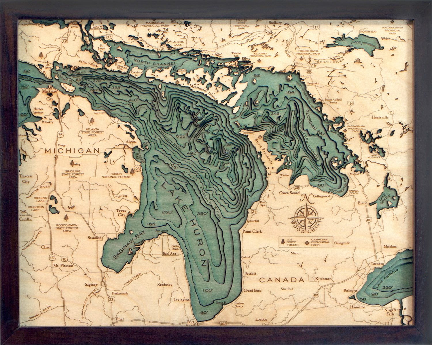
It wouldn’t be the Mitten without Lake Huron. As one of the five Great Lakes, Lake Huron plays a crucial role in the geography of Michigan, creating the shoreline that gives the state resemblance to a cold-weather accessory. This calm, blue lake offers gorgeous lighthouses, boating, paddling, state parks, and 200 miles of picturesque coastline from Standish to Mackinaw City.
Lake Huron, originally called La Mer Douce, or the freshwater sea, boasts some of the most incredible beaches, mysterious shipwrecks, and clear swimming waters in the state. The lake is home to Georgian Bay, the largest bay in the Great Lakes, and is surrounded by the largest limestone quarries in the world.
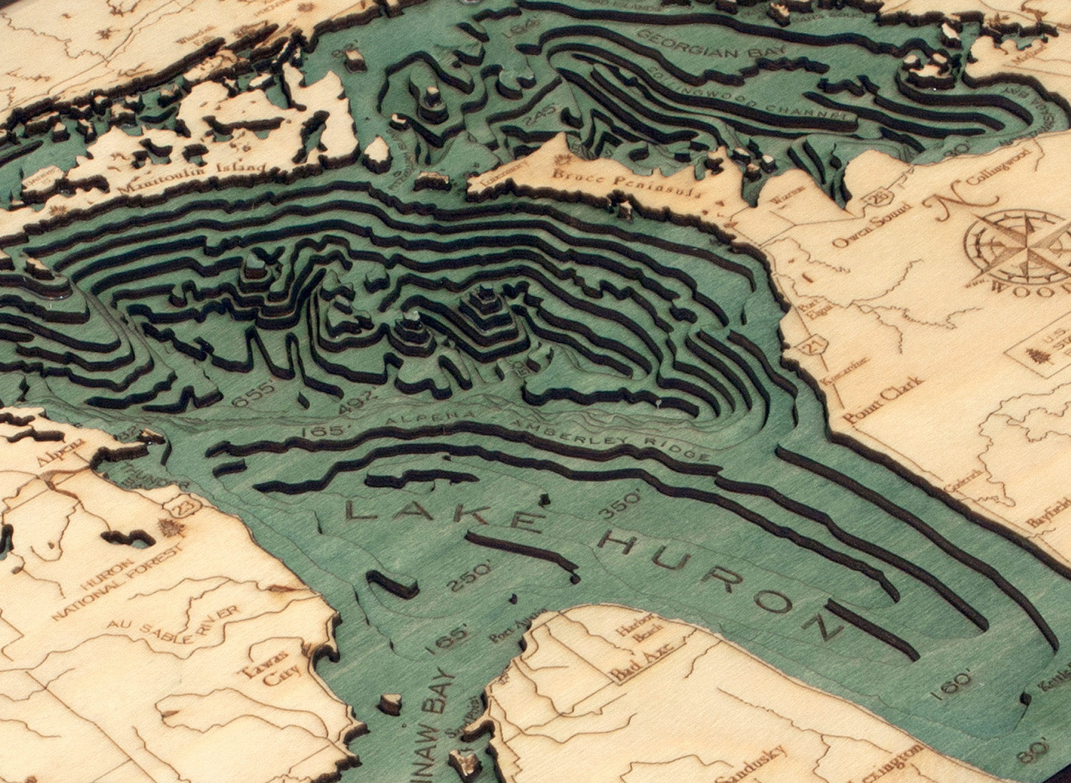
Our topographical map displays the lake’s incredible depths using laser-cut layers of high-quality birch. After cutting, an artist glues the layers together to depict the lake's topography and then hand-stains the water to create dimension and beauty. Points of interest are etched into the lake art’s surface before being finished with a custom wood frame and acrylic sheet for added protection.
Display your love of Lake Huron with this beautiful lake art.
Points of Interest on Lake Huron Map:
Saginaw Bay, Port Huron, Georgian Bay, Drummond Island, Mackinac Island, Mackinaw City, St. Joseph Island, and Sault Ste. Marie
Lake Huron Lake Art Details:
- Made of high-quality birch
- Solid wood frame made to fit
- Laser-cut depth
- Engraved names and locations
- Acrylic glass protection
- Arrives ready to hang