Traditional maps display a chosen area in a two-dimensional fashion. However, if you want a piece of art that seems to jump off the wall at you and showcases your favorite location in an artistic and unique way, three-dimensional wood maps are a fantastic choice. But how are these distinctive maps made? It’s the details that make three-dimensional wood maps one-of-a-kind.
What is a 3D Map?

When you stand beside a mountain, it’s easy to see how tall it is. But how do you know what a mountain, lake, or ocean looks like if you see it on a map? Physical 3D maps are miniature versions of the physical terrain of a specific area. These 3D maps, also called raised relief maps, physical terrain maps, and 3D topography maps, have various uses ranging from artistic wall hangings to architectural representations.
If you’ve ever seen a topographical map, you’re familiar with the distinct highs and lows that showcase the mountains and valleys in a way that lets you see the landscape up close. In addition, many of these maps use vertical exaggeration to highlight the different landmarks. This type of scaling is done by stretching the height of the landmarks to make it easier for people to see the difference between buildings, landmarks, and other environmental features.
Although topographical maps are great for displaying your favorite travel destination souvenir, maps showcasing bodies of water are becoming more popular due to the vibrance and beauty of their designs.
Where Do Measurements for 3D Wood Maps Come From?

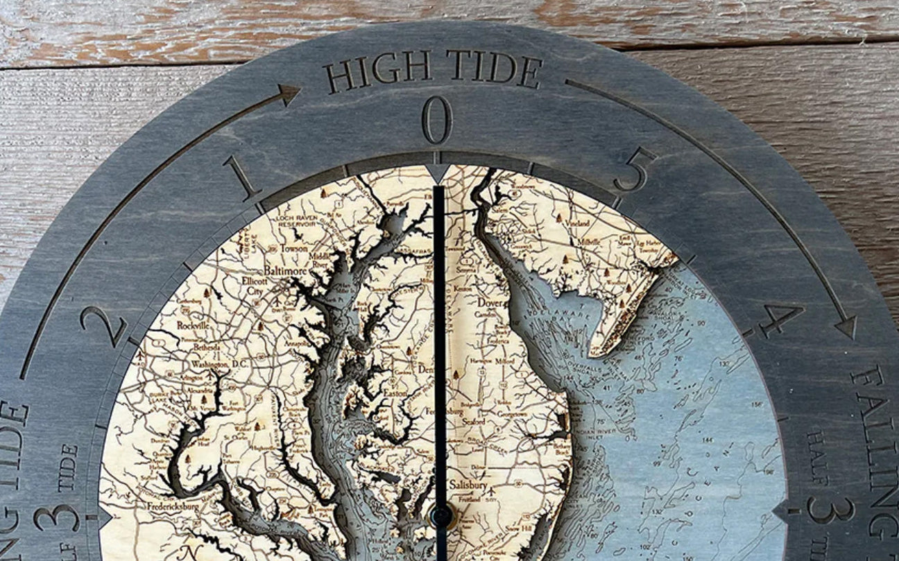
Topographical maps are used to measure the height of mountains and other elements on land. But what about in the water? Bathymetric charts are similar to topographical maps and are the first step in creating the lake art that Wood Chart is famous for. A bathymetric chart is similar to a topographic map, except that it depicts the submerged features of the ocean, sea, and lake bottoms.
Each Wood Chart map begins with a bathymetric chart of the chosen destination, whether it’s Boston Harbor, the Baja Peninsula, or one of Michigan’s beautiful lakes. Many wood maps you’ll see for sale have a moderate amount of detail when it comes to the exact depth of their artwork, but they often lack key details and points of interest beloved by residents and visitors to the map’s location. One of the things that makes Wood Chart the most unique is that each map has two-millimeter precision for its laser cutting, making it the most intricate 3D map on the market.
Each wood map created by Wood Chart takes months of planning, research, and dedication. Bathymetric charts are drafted to show the chosen location in incredible detail, allowing artists to create a visual representation that is more precise than any other map you’ll find. Wood Chart has the expertise to make its wood and lake art one of a kind, from adding small coves and outcroppings to barrier islands and reefs.
Materials for Making 3D Maps

Artistic 3D maps, such as those displaying lake art or the water around your favorite island, are a fantastic way to decorate your home or office. The maps have undergone a popularity boom in recent years, with people searching worldwide for wood lake maps, wooden topographic maps, and nautical art maps of their favorite destinations.
These maps are available in several different styles. You can find them made with foam, 3D printers, plastic, metal, and wood, just to name a few. Of course, the type of map an artist is creating determines the materials needed. For example, a 3D printer can create a custom one in a matter of a few hours using a string of heated plastic, depending on the level of detail. Although it can be exciting to create your 3D map, these versions tend to be better suited for small projects or cityscapes rather than artistic wall hangings.

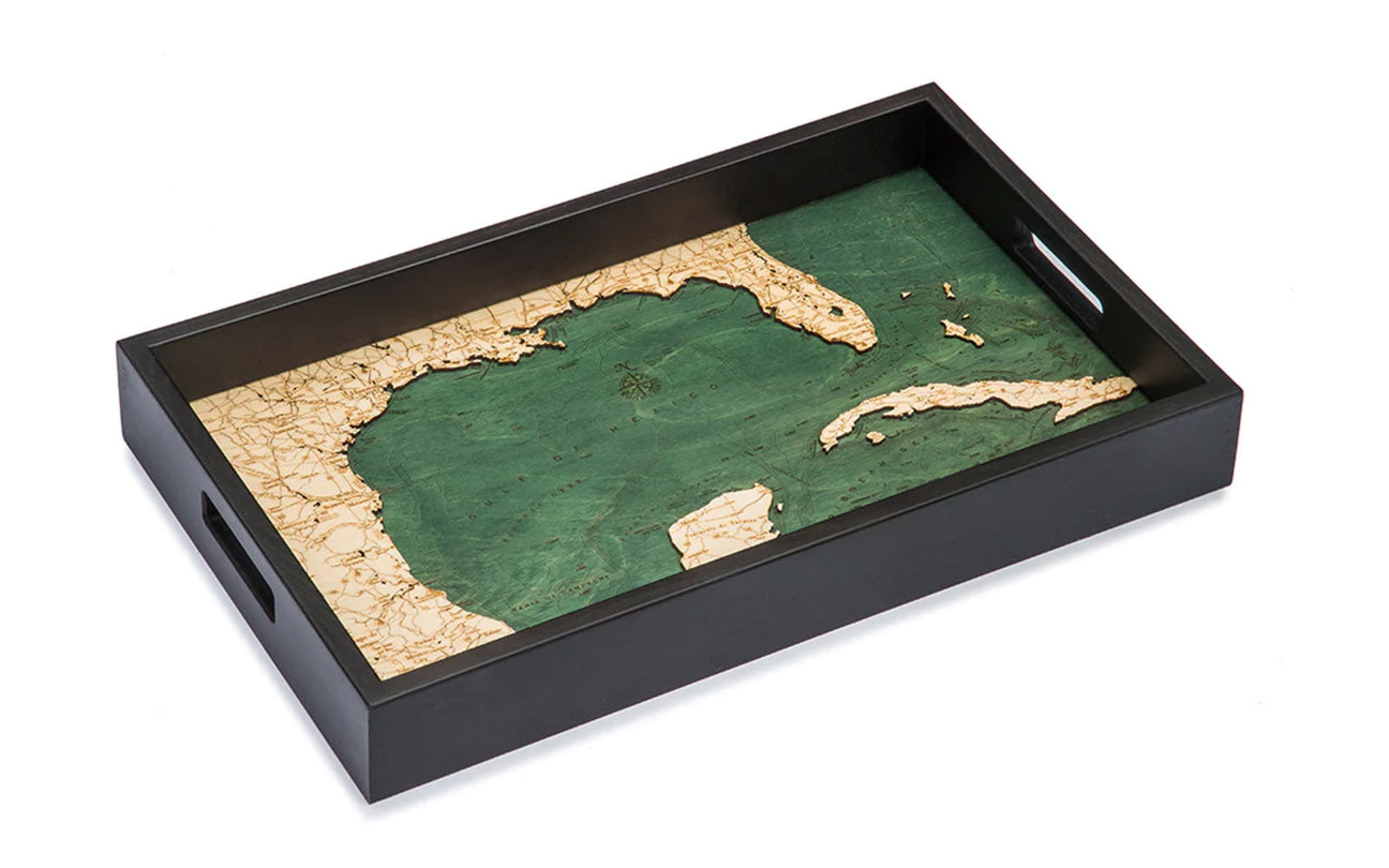
For high-end wood maps and lake art, companies use special wood lasers and stains to create a custom look. At Wood Chart, our artists use the highest quality birch wood. The intricacy of the map coupled with the beautiful texture of the wood creates a beautiful piece of art that will remind you of your favorite destination each time you look at it.
How Are 3D Maps Made?
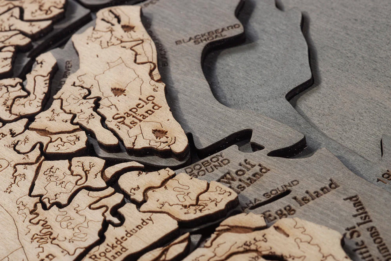
The way each 3D map is made depends on the style. For 3D wood maps, such as our lake art of Michigan’s Great Lakes, an artist begins with the readings from a bathymetric chart. Next, depth and dimension readings are transferred into a laser cutter, which precisely cuts pieces of birch into layers depicting the depths of the water and land. Once each piece is cut, the artist places each layer by hand and applies a special glue to hold the layers together.

Once the pieces are assembled, the beauty of the map starts to come into focus. The area on the map representing the water is hand-stained to showcase the shorelines and locations of the land and islands. Landmarks, points of interest, and main roads and thoroughfares are selected for each location. Then an artist laser engraves them into the surface, adding even more detail to our wood maps and lake art.
To complete the look, our maps are fitted with custom size frames made with solid natural wood. Using a custom frame allows us to select the dimensions that fit the landmarks on the map, rather than having to cut and trim to fit into a standard size frame. Many of the maps available at Wood Chart are available in multiple frame styles to coordinate with the unique color stain of the map’s water. Choose from a classic dark brown, grey, or a farm-style with etchings and engravings on the frame’s surface.
Our Favorite 3D Wood Maps
Choosing a 3D wood map or piece of lake art is a fantastic way to decorate your home or office. It also makes an excellent gift for anyone who wants to show off their love for a destination that holds a special place in their heart.