WoodChart
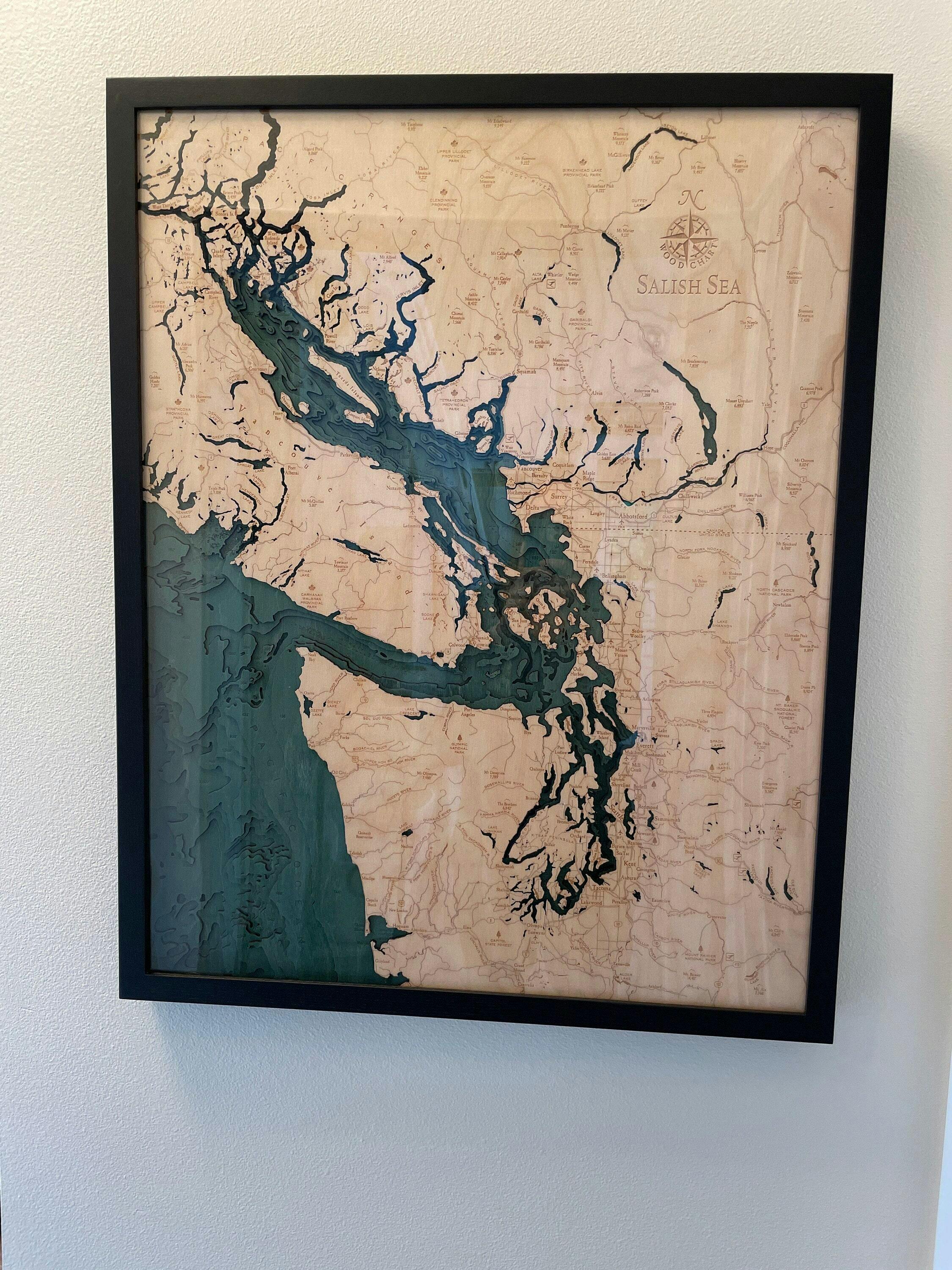
Salish Sea, Washington 3-D Nautical Wood Chart, Large, 24.5" x 31"
- Regular price
- $375.00
- Sale price
- $375.00
- Regular price
The Salish Sea offers more than just beautiful vistas, it is a biologically rich marine area and has great cultural significance. The waterways including the Pacific Ocean are etched in detail on this 3D nautical wood chart, revealing the majestic depths where marine life of all kinds thrive. Each island represents unique topography to explore, appreciate, and memorialize with a nautical wood chart.
The Salish Sea wood map displays the bathymetry of the surrounding waterways in intricate detail. The depths of the water and details of the coasts and islands are expertly etched in high-quality Birch and completed with engraved points of interest. This 3D wood map is finished in a custom frame and arrives ready to hang.
Points of Interest on the Salish Sea, Washington, 3D Wood Map Include:
Vancouver, Seattle, Pacific Ocean, Olympic National Park, Vancouver Island, Puget Sound, San Juan Island, Kitsap Peninsula, Victoria, B.C., and North Gulf Islands
Salish Sea, Washington 3D Nautical Wood Chart Details:
- Made from high-quality Birch
- Solid Wood Frame Made to Fit
- Laser-cut Depth
- Engraved Names and Locations
- Acrylic Glass Protection
- Arrives Ready to Hang
Frame Styles:
Classic, Dark Brown Wood Frame, Greenish-Blue Water ColorRustic Grey Frame, Greyish-Blue Water Color