Maps have been a functional part of our lives for thousands of years. Evidence of mapping was found on Babylonian clay tablets dating back to 2300 B.C. As humans, we have been trying to find our way around this great big world since the beginning of time!
The stars inspired the desire to plot our way from here to there. Astronomers and astrologers in the second century, B.C., linked the stars to horoscopes and required exact mapping of someone’s birthplace on a map. This earliest invention of geography is credited to Claudius Ptolemy, though his intention was not to clarify directions but to improve horoscopes.
Map Basics
There are basic parts of a map that are familiar to most of us. For example, directions on a map are indicated with a Compass Rose or a North Arrow. A map using only an indication of north usually has an ornate North Arrow indicating the direction on the map intended to be north. A Compass Rose indicates the four cardinal directions.

Cardinal Directions on a Wood Map
- North
- South
- East
- West
The Global Grid
Unless you are someone who regularly studies maps, you may have failed to notice the functional lines of latitude and longitude that run through most maps. However, it is these lines that allow us to pinpoint specific locations. Even your GPS today uses these precise coordinates to get you from place to place.
Early maps were often used for a specific function, such as depicting a trade route or a hunting ground. These maps were works of art, expensive to make, and an indication of prestige to own. In many cases, the artwork in the center of the map would be shown in great detail, but the edges would be less clear and specific.
Flat Earth? You are Flat Wrong
The earliest maps reflected the two-dimensional world—the flat earth that the earliest cartographers believed in. Astronomers like Ptolemy would antagonize the flat-earthers with arguments for a spherical world, citing the movement of the stars in the sky. As travel extended beyond the curve of the horizon, many people discovered the misunderstanding and realized they were flat wrong.
Famous Cartographers Through the Ages

Cartography is the science or practice of drawing maps. Many famous cartographers throughout history have enhanced the art and science of mapping their corner of the world. As cartographers mapped a larger and larger world, exploration increased, lands were discovered, and the need to expand boundaries continued.
Cartographers of the Ages
- Nicholas de Fer
- Arno Peters
- Juan Jose Valdez
- Marie Tharp
In every society, maps served as critical economic, political, and personal tools, but there was little consistency with how and why they were made. As maps expanded, so did man’s understanding of the challenge of measuring a planet on which we are standing. One of the ways cartographers adjusted to this challenge was to differentiate measurements of land and water – topography and bathymetry.
Topography vs. Bathymetry on a Wood Map

The French engineer, J. L. Dupain-Triel, developed the concept of using contour lines to show different elevations on a map in 1791. This method allowed accurate depictions of land contours and elevations on a flat, two-dimensional map. The first topographical maps were compiled, drawn, and edited by hand using data, including direct field observations.
Bathymetry is the underwater equivalent to topography. While the first recorded measurements of bathymetry date back to 1840, it was the first detailed map of the ocean floor in 1957 that helped revolutionize our understanding of the geology of the seafloor. Bathymetry is essential for navigation and ocean science, including:
Bathymetry is Essential on a Wood Map
- shows changing coastline features
- depicts the effects of climate change
- monitors beach erosion
- indicates if sea-level rise
- shows subsidence (land sinking)
How Early Maps Were Made
The first maps were made by hand, usually by painting on parchment paper. Imagine the pressure of trying to draw the same thing over and over! The earliest maps were made by measuring the position of various objects and then measuring the distance and angles between each point. Along the way, the invention of tools like the magnetic compass allowed the cartographers to improve their craft and improve map quality and accuracy.

The most common cartographer’s tools consisted of a quill, ink, parchment paper, compasses, calipers, and a ruler. While the tools were common, the skill to create the maps while traversing the terrain was unique. Early experts in map-making rarely got lost and drew their maps while in the field as they completed other tasks.
Today’s cartographers have a plethora of options for map-making. Most maps are made from computer software that takes the guesswork out of the process and relies on solid mathematics. The most common software programs include:
Popular Map-Making Software
- CAD
- GIS
- specialized illustration software
Unlike the mapmakers of yesterday, today’s cartographers can draw from satellites, aerial photography, and information databases. In addition, we can all make maps on our phones, recording our location as we walk from place to place. Maps created from this information are presented in a variety of forms that we use every day.
What Kinds of Maps Do We Use Today?

Your smartphone is probably the most popular map we all use every day. The “Locator” function enabled on our phones allows us to open the Maps app and immediately get directions to the “Pizza Place Near Me.” Or turn-by-turn directions to the local pub where your friends are waiting for you to begin the cribbage tournament.
The data collected by cartographers through the years has served to perfect the topographical maps we use today, making our lives that much easier. The whole purpose of the map is to communicate the things that were discovered from the geographic information that was collected. Thus, maps have been making our lives better for centuries!
Wood Maps are Popular Today
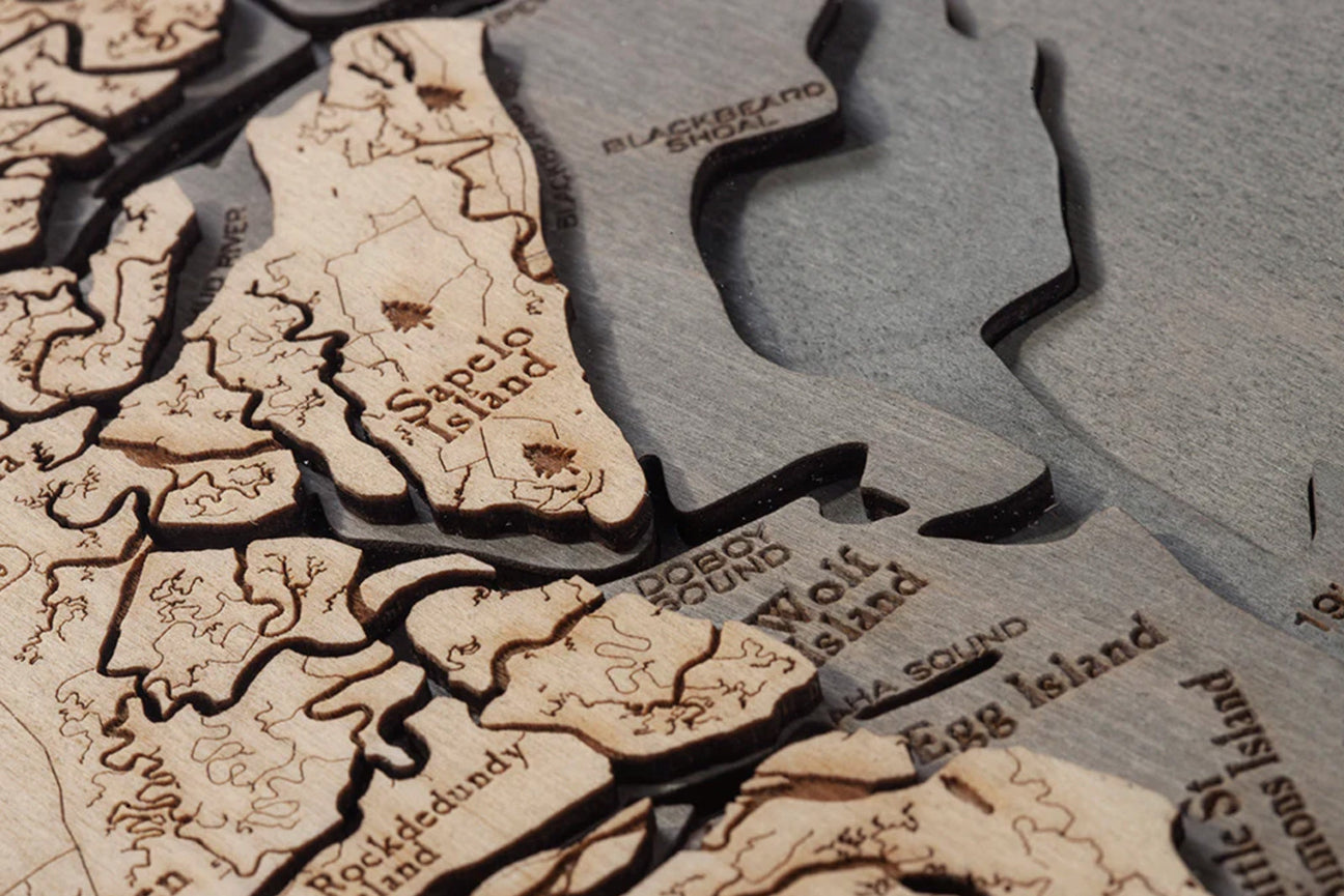
Wood maps are used to enhance the nautical décor in our homes and serve a more practical purpose – to help us appreciate the lands and waterways that play a special part in our lives. A high-quality wood map is both an appreciation of history and a nod to the advancements of today’s cartographers. The perfect blend of old and new, the wood map is a timeless recreation of the depth and breadth of nature’s beauty.
Topographical maps are used to understand the shape of the land. By studying the slopes and plains, architects and city planners have been able to ensure our cities, communities, and homes have been built on solid ground. The topographical map outlines both natural and man-made features, giving us precious insight into the changing landscapes around us. Topographical maps have several uses, including:
Main Uses of Topographical Maps

- geographic planning
- large-scale architecture
- earth-based endeavors
- civil engineering
Don’t think you use topographical maps in your daily life? You may be surprised by the common people who use topography every day. You may just be one of them! Other people who use topographical maps on a regular basis are:
Everyday Users of Topographical Maps
- hikers
- snow skiers
- city and county planners
Topographical maps describe the shape of the land. They help you best navigate how to get from here to there, outlining where things are and how to get to them. They may be best described as an important tool that can represent the three-dimensional landscape in two dimensions. When you can read a topographical map, you are informed about the location of peaks, valleys, ridges, and many other land features around you.
Why Buy a Wood Map?
A wood map is the perfect commemoration of a location that is special to you. Whether it is an island, a coastline, or an idyllic lake in Maine that resonates with you, a wood map is a perfect addition to your home.
A handcrafted wood map instantly elevates your mood as you study the landmarks and waterways that wrote the backstory of your ultimate adventure.
Reasons to Buy a Topographical Map

- inspire travel
- beautify your space
- locate surface features in an area
A wood map seamlessly blends the lands you traversed with the shoreline you followed as you basked in freedom and sunshine. The topography of the areas you explored is clearly contoured on the topographical map with the lines of the peaks and valleys you ascended as you made your way through the mountains. With the purchase of a wood map, you become a part of history and fully appreciate the progression of the topography in your area.
What Kind of Wood Map Should You Buy?
One of the most understated benefits of a wood map is that it comes in many forms. Each wood map tailors to the interests and preferences of the person who brings it home. Do you want function or beauty? Good news! You can have both.
Types of Wood Maps
If a large wood map of the Great Lakes is what would make your home office complete, a wood map is absolutely for you! The topographical map not only inspires you to daydream about your next trip to the U.P., but it also catches the eye of visitors who will sit for hours, letting you regale them with your stories of life on The Mitten.
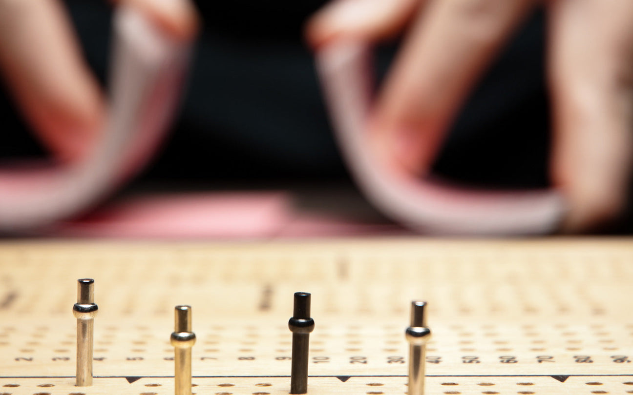
What is in a Cribbage Board Wood Map?

The cribbage board is perfect for the game-playing traveler. A wood map that functions as a centuries-old scorekeeper is the ultimate compliment to that standard deck of cards. (That deck of cards is also centuries old, by the way.) Keep excitement in your cribbage game with a conversation about your trip to the United Kingdom, the topographical map of which is on the surface of the board.
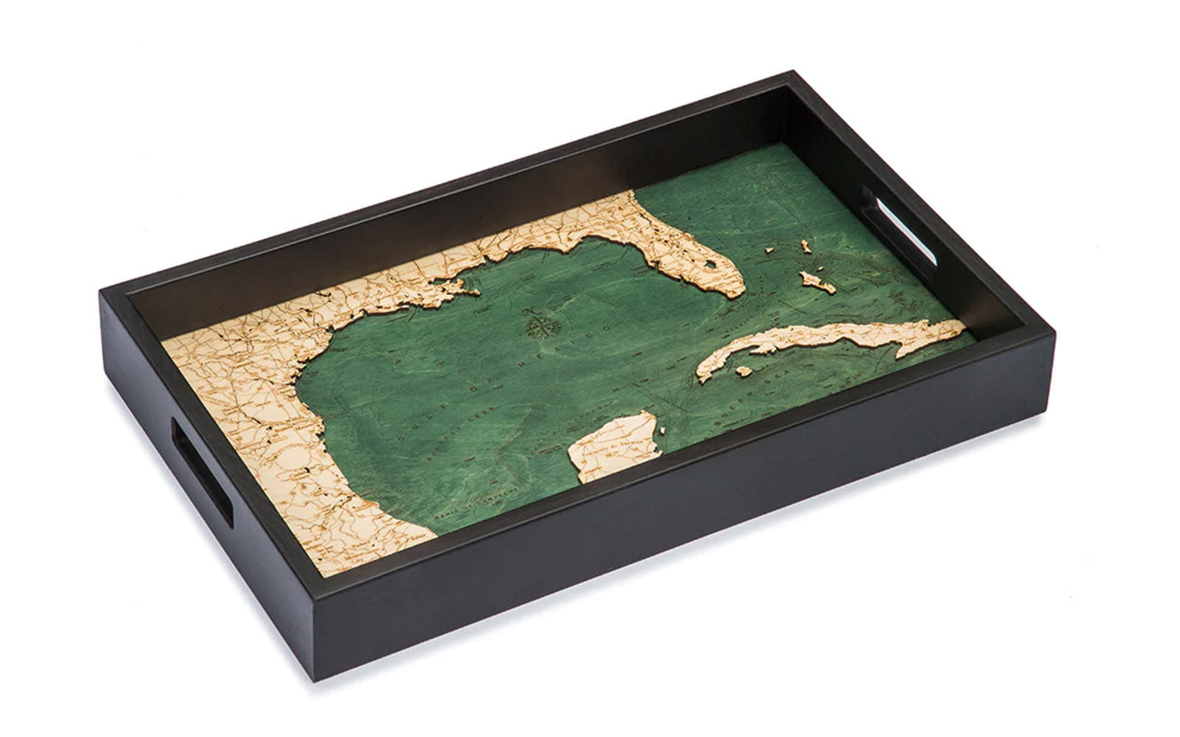
A wood chart serving tray is the quintessential option for featuring the tea set you bought during your travels in Japan. In the top 10 tea producers globally, Japan generates almost 90,000 metric tons of leaves each year. Looking for a stunning presentation for that Asian-inspired Hot Toddy? A wood map serving tray elevates your service while identifying the country of origin.
Wood Map vs. Cork Map

The casually elegant cork map is a subtle addition to any home topographical map collection. Just as at home on your desk as it is on your mantle, the cork map offers exquisite detail in a neutral palette that celebrates the topographical features of your hometown of Santa Barbara.
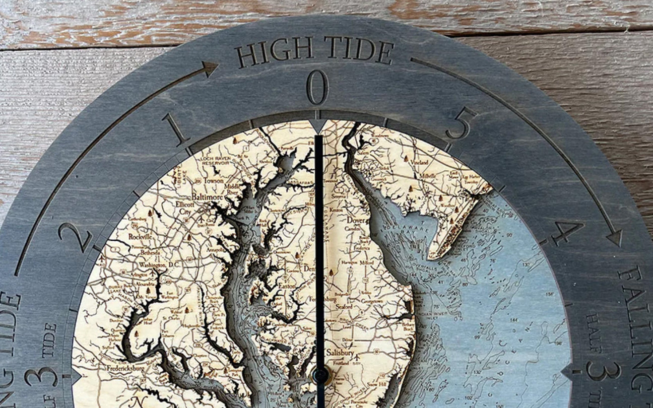
It’s time to consider another form of a topographical map. We learn time and time again that there is no time like the present. With all the references to time in our everyday life, a reminder that time is of the essence will come with each tick of your Ireland wall clock. The wood chart will show you the Emerald Isle in a whole new light. A castle on the Irish Sea awaits!
Your Life is Better with Topographical Maps
If you do not believe your life is impacted by the creation and evolution of topographical maps, you need only look at the nautical wood map of the lake closest to the neighborhood where you grew up.

Maps keep us from getting lost. They give us a unique perspective of what is around us and which direction we should go. Our maps, like our mapping systems, have evolved, providing complicated information in a simple way to create a blueprint of our history. Maps connect us to our memories and remind us how far we have come.
The cartographers through the centuries had one goal in mind when creating their topographical maps – to put the world within reach. As the stars aligned and rivers gave way to oceans that revealed new lands, topographical maps, and their makers gave future generations the ability to experience, and ultimately indulge in, the consuming desire of wanderlust.