Ah, the Midwest. Whether you are a frequent visitor or it’s on your bucket list, you can find the most amazing views and slices of nature right here in the United States! It’s a perfect family vacation spot or a destination for your next solo getaway.
Maps are wonderful works of art in your home; they provide educational and historical value while also being beautiful, unique pieces that are sure to be conversation starters. Wood maps are even better! The special wood maps available at Wood Chart provide a three-dimensional look at some of your favorite places.
Why Should I Visit the Midwest?

The Midwest has tons to offer. It has big-city experiences for those who love the bright lights and buzzing energy, but it also has quiet, sleepy small towns and beaches along the coasts of the Great Lakes.
In addition to its appealing tourist destinations, the Midwest is known to have some of the kindest people in the country. Midwestern hospitality is prominent and will make all guests and tourists feel like they have found their second home. A perfect example of this is how the Midwest has a wide variety of bed-and-breakfasts - everyone is just itching to host and get to know you!
Why Are the Great Lakes Special?
The Great Lakes are arguably some of the most beautiful natural structures in the United States, so why not make them your new family vacation spot? There are five great lakes included in the system, all with individual characteristics that make them wildly different:
- Lake Superior
- Lake Huron
- Lake Ontario
- Lake Michigan
- Lake Erie
Each lake is a special spot and is worth a visit, even if you think it might be similar to one of its neighbors! For example, Lake Michigan has some cool beaches with city views of Chicago, while the river in between Lake Erie and Lake Ontario has one of the most incredible natural structures in the world: Niagara Falls.
How Were the Great Lakes Formed?

Nearly 20,000 years ago, the Great Lakes were formed from a melting glacier called the Laurentide Ice Sheet. However, it wasn’t until about 3,000 years ago that the Great Lakes started to look like we know them today. Since their creation, their channels and rivers have been used for transporting goods, fishing, and other business and recreational activities.
A fun fact about the Great Lakes is that they are the largest freshwater lake system in the entire world! They are also home to around 35,000 islands, making them perfect for explorers and adventure-seekers of any age.
Why Do I Need a Midwest Wood Map?
A wood map is a great way to commemorate your travels to the Midwest. If it’s a bucket-list destination for you, it’s a great reminder of a future travel goal! Wood maps come in a wide variety of shapes, sizes, and colors.
3 of our favorite wood maps of the Midwest are:
- Chicago, Illinois 3-D Wood Chart
- Great Lakes 3-D Nautical Wood Chart
- Lake Minnetonka, Minnesota 3-D Nautical Wood Chart
Chicago Wood Map
The Windy City is a destination with the best of both worlds: a beautiful cityscape and peaceful, white-sand beaches. This unique piece showcases just how unique the Midwest can be, depicting the city’s grid structure with different districts as well as the beautiful coast of Lake Michigan.
Wood Map of the Great Lakes

The Great Lakes are a classic; why not see your favorite lakes made of wood? Our wood map shows the intricacies of the lakes, carefully sculpting the depths beneath the water’s surface. Additionally, our 3D wood chart is a large piece, which makes it perfect for a single statement piece or perhaps the focal point of a gallery wall.
Wood Maps of Smaller Lakes
We can’t forget the little guys! Part of what makes the Midwest and the Great Lakes so special is all the islands and inlets in the area. This Lake Minnetonka wood map almost looks like a piece of abstract art with splashes and swirls of blue, but upon further inspection, its viewers will notice that it’s an advanced depiction of lakes made of wood!
How Are Wood Maps Created?
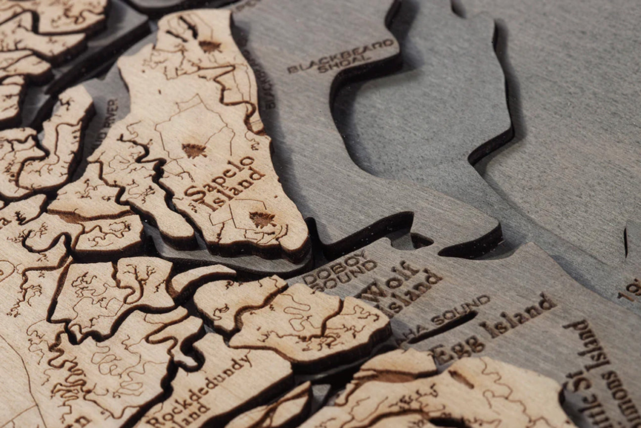
The process of sculpting a wood map is unique and intricate. The artists at Wood Chart combine art and science to create these pieces. First, the highest-quality Baltic birch wood is sourced and sanded down to create wood slabs. Then comes the most interesting part: the laser!
Lasers are utilized to create precise cuts and elements of wood maps. Though all measurements are taken by humans, the lasers take the guesswork out of the process, leaving a perfectly clear depiction of your subject.
Finally, all wood maps are hand-stained and dyed with various pigments. The variety of colors available, including neutral colorways or bold palettes, can match or complement any décor!
Gifting a Wood Map

If you are looking for a unique gift, look no further! There are many folks who would appreciate the exciting gift of a wood map. Wood Chart also offers many other products with their carvings and artwork, making your search for that perfect present that much easier.
Two of our favorite recipients of wood maps are travelers and teachers. Travelers are always looking for ways to remember their most special trips, and we can guarantee that this will be a treasured way to do so. Teachers love educational tools, and wood maps are eye-catching and educational, appealing to students of all ages.
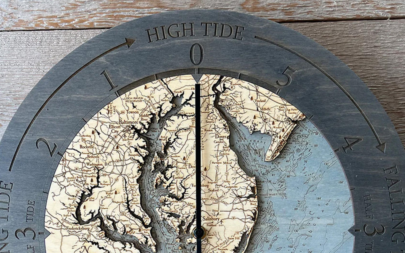
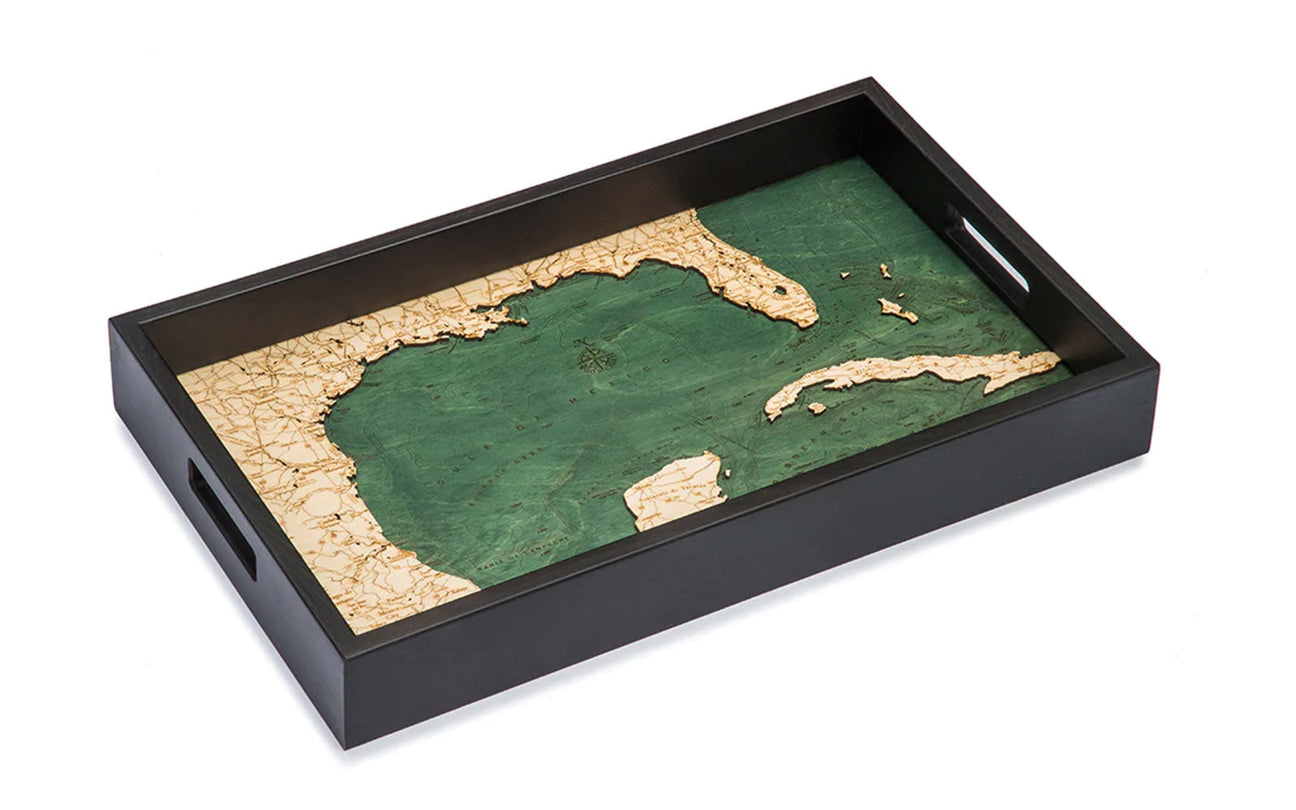
Consider gifting the traveler in your life a Lake Superior Serving Tray to bring out for special occasions. They will serve their appetizers in style and share all their travel tales! Your favorite teacher may like a Great Lakes Clock. Wall clocks offer excellent décor opportunities and can aid in a teacher’s next geography lesson or session on telling time!
What’s the Bottom Line?
You need a Midwestern Wood Map! Wood charts are classic pieces that will stand the test of time. They will make the perfect gift for anyone on your list, even if it’s just for yourself!