There is a primal call of the sea for those with the spirit of the traveler. Across the globe, seas ebb and flow with life, adventure, and wonder. You can go further than you ever thought possible on international cruises and adventures through foreign waterways.
The beauty, depth, and wildlife abundant in each are as unique as each person crossing the waters to experience them. Elegantly reflected on a nautical wood map, these seas draw attention and fan the flames of curiosity of every sea-worthy passenger.
By Plane or By Boat – Just Go

Whether you choose to cross international waters by plane or by boat, the wonders of each body of water await you. From the Caribbean Sea near Cuba to the English Channel of the United Kingdom, the waters of the world fill great basins, covering submerged mountains and underwater ridges.
Ancient and mysterious, there is much to be seen in the international seas across the world. It all starts with a commitment to just go. Before you book that ticket, here are a few of the international seas you will want to see.
8 Best Countries for International Sea Seeing
- Cuba
- Ireland
- Italy
- Japan
- Korea
- New Zealand
- Scandinavia
- United Kingdom
1. Cuba – Our Closest Neighbor to the South

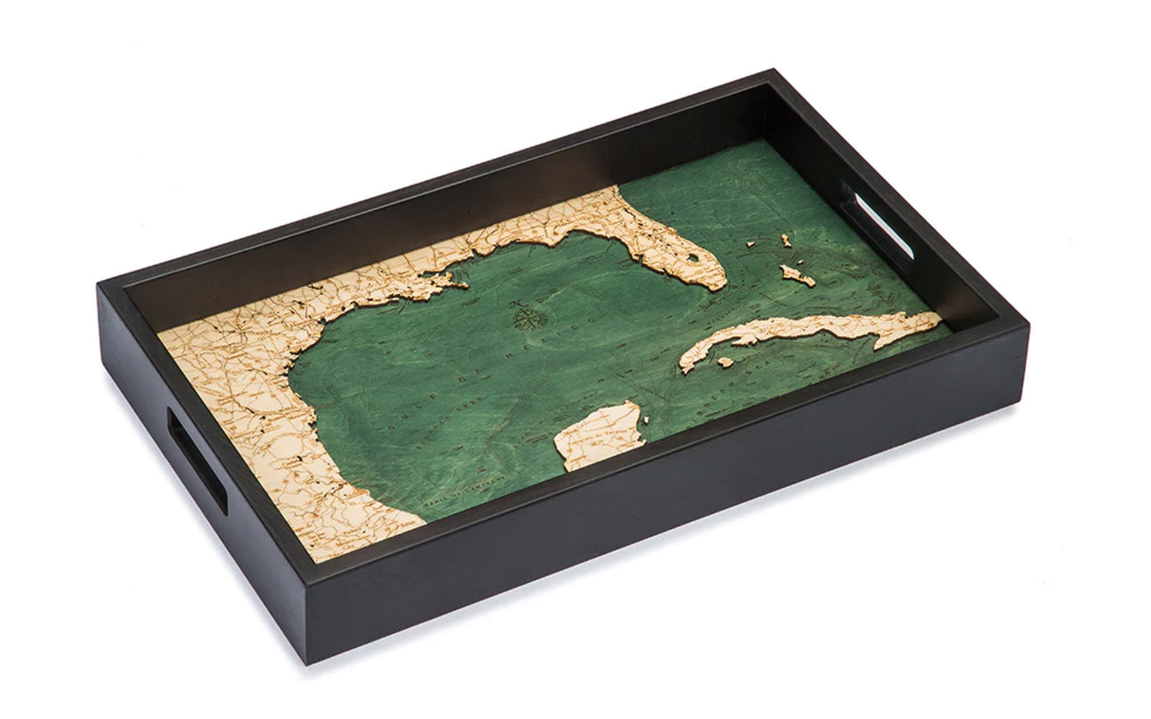
Located where the Gulf of Mexico, Caribbean Sea, and Atlantic Ocean meet, the Republic of Cuba is the largest island in the Caribbean Sea. It is legendary for its cigars and rum made from sugar cane. It is well-known as the least commercialized and most exciting island to visit in the Caribbean.
The Caribbean Sea is home to the Mesoamerican Barrier Reef – the largest barrier reef in the world. This sea lies south of Cuba, north of South America, and connects with the Gulf of Mexico and the Atlantic Ocean to create one of the world’s largest saltwater seas, covering over one million square miles.
The boundary nations of the Caribbean Sea are many and include:
Boundary Nations of the Caribbean Sea
- Antigua and Barbud
- Bahamas
- Barbados
- Belize
- Columbia
- Costa Rica
- Cuba
- Dominica

The Atlantic Ocean surrounds Jamaica; the island itself is smaller than the state of Connecticut. It has mountain regions and other bodies of water, leaving a
One surprising fact about Jamaica? It does have a bobsled team, mon.
Grand Cayman is a financially self-sufficient British dependent and known as a haven for money. However, Grand Cayman is also a world-renown culinary capital and a top choice for recreational diving.
The Gulf of Mexico, consisting of primarily shallow waters, formed over 300 million years ago. The deepest point of the basin floor reaches over 14,000 feet deep. This deep trough was created as the continental shelves in the shallows collided and the floor sunk.
2. Experience the Island of Ireland
It was not unusual for Irish immigrants to remain at sea for twelve weeks to reach the United States in the nineteenth century. Today, you can take a nautical cruise to the Emerald Isle in five days.

The Irish Sea separates Ireland from the mainland of the United Kingdom. This sea serves as a trade route for shipping and transport, a dependable source of fishing, and a natural resource providing wind energy and power generation from offshore wind farms.
The Irish Sea provides the best habitat to the world’s second-largest fish – the basking shark. The best time to see these sharks from land or boat is anytime from April through early August. Whether staying for a while or just passing through, this gentle giant can put on quite a show for spectators!
The Celtic Sea is the section of the sea in the Atlantic Ocean off the south Ireland coast. With blurred lines between the end of the Atlantic Ocean and the beginning of the Celtic Sea, a detailed wood map can establish some boundaries with the Celtic Shelf present along the seabed.
3. The Mesmerizing Seas of Italy
Italy’s boot puts its jaunty heel right into the midst of the surrounding waters, separating four major seas. The stunning waters surrounding this peninsula have been a top destination for many seasoned travelers. However, one trip is never enough!
4 Major Seas of Italy

- Adriatic
- Tyrrhenian
- Ligurian
- Ionian
The Adriatic Sea separates the Italian Peninsula from the Balkans. It is the northernmost arm of the Mediterranean Sea and is best known for its warm temperatures and calm waters. Crystal blue, clean waters give a clear view to the sea bottom made from round pebbles and favored by swimmers and divers.
The gorgeous Tyrrhenian Sea is one of the most under-rated bodies of water in the Mediterranean. This sea has gained historical significance due to its strategic trade routes, but its stunning beaches and mesmerizing blue waters should not go without mention.

Between the Italian Riviera and the island of Corsica lies the Ligurian Sea. The Italian Riviera is home to the famous Cinque Terre – five beautiful hillside towns along the rugged shoreline of the Riviera. These must-see towns provide sensational views of the water, unforgettable cafes, and friendly people to share the experience.
The Mediterranean Sea connects these seas to the Atlantic Ocean, creating trade routes and converging along the beautiful shores of the twenty-two bordering countries. With almost 29,000 miles of coastline, this sea separates Europe and Africa and opens to the Atlantic Ocean at the famous Strait of Gibraltar.
4. The Many Islands of Japan
With over 18,000 miles of shoreline, Japan is an archipelago made up of thousands of islands. No matter where you are in Japan, you are never more than ninety-three miles from the sea. Nautical art reflects the beauty of the water that is an integral part of life in Japan.

The Pacific Ocean provides significant nautical trade routes for Japan’s exports to and from Australia and New Zealand. While the Pacific Ocean provides sufficient beaches, the Japanese people take their beach season very seriously and prohibit swimming in the off-season.
The Sea of Okhotsk is dotted with many islands belonging to either Japan or Russia. Many of these islands are uninhabited and provide excellent breeding grounds for seals, sea lions, and sea birds.
The calm waters of the Sea of Japan are not subject to tides due to being fully protected by the Japanese archipelago. Without bays, large islands, or capes, the Sea of Japan provides productive fishing, the top economic activity of the area. A nautical wood map displays the depths of the seafloor, revealing the open waters below that teem with fish and wildlife.
5. The Korean Peninsula
The peninsula of Korea is, by definition, surrounded on three sides by water. Koreans refer to the bodies of water as the East Sea, the West Sea, and the South Sea; however, the more popular names are the Yellow Sea, the East China Sea, and the Sea of Japan.

The Yellow Sea is famous for being one of the world’s largest continental shelves covered by water. This makes for excellent fishing and is a draw for migratory birds. Its yellow color comes from the waters that flow into the sea, carrying mineral-rich soil that turns the water yellow.
The East China Sea is highly fished by China, Japan, and North and South Korea. Covering approximately 480,000 square miles, the East China Sea also serves as a major trade route to Japan and other North Pacific ports.
Separated from the Pacific Ocean by the Japanese archipelago, the Sea of Japan has almost no tidal activity and has low salinity but is home to the Giant Squid. The rarest species living in these waters is the Japanese Roughshark. Only a handful have ever been seen.
The depths of these waters, as reflected on a nautical wood map, hold many mysteries; the Roughshark is just one.
6. New Zealand is More Than a Pretty Place

The island of New Zealand sits in the Pacific Ocean, roughly 1,200 miles off the south-eastern coast of Australia. Though it seems so close, it is over a five-hour plane ride to the land of rugby, the kiwi, and The Kea.
The Tasman Sea is the expanse of water between Australia and New Zealand. Measuring about 1,200 miles across, New Zealand was named by the Dutch explorer Abel Tasman who was the first to encounter New Zealand and Tasmania.
Above all, New Zealand is a group of Pacific Islands. As it has grown and established independence, NZ more readily identifies itself politically and culturally as an island nation. Home to more than four million people, New Zealand is famous for its picturesque landscape and sheep. Lots of sheep.
7. Scandinavia is a Group of Countries
Scandinavia is the common name for several countries in Northern Europe. It is also referred to as the Nordic Region.
The Countries of Scandinavia
- Denmark
- Norway
- Sweden
- Finland
- Iceland

At 1,150 miles long, the Scandinavian Peninsula extends through a couple of waterways, including the Barents Sea. The lines of a nautical map detail the bathymetry of the seas, blending one into the other, yet showcasing the uniqueness of each.
The Barents Sea is considered a shallow sea shelf at only 750 feet deep. Despite its proximity to the Arctic, the warm Atlantic waters flowing into the Barents Sea keep it from freezing. Even in September, the sea is completely ice-free.
The Norwegian Sea has long attracted skilled fishers to its waters along the coast of Norway. Blue whiting, haddock, and cod are plentiful in these waters and create a significant economic contribution.
The North Sea is a waterway of diverse importance for Northern Europe. Equally important in fishing, recreation, shipping, and tourism, the North Sea has recently looked to improve its already impressive resume by adding energy resources and early efforts in wave power.
The Baltic Sea is the largest expanse of brackish water in the world. With a surface area of over 146,000 square miles, the Baltic Sea encompasses other waters as well.
Other Seas Within the Baltic Sea
- Bay of Bothnia
- Gulf of Bothnia
- Gulf of Riga
- Bay of Gdansk
- Gulf of Finland
8. The United Kingdom is Surrounded by Water
While the UK is surrounded by water, it may be comforting to know that the surrounding seabed is owned by the Crown Estate, out to twelve miles from land. For those of us hooked on British dramas, that means Queen Elizabeth owns both land and sea!

The English Channel, often called the Channel, is the busiest shipping area in the world. Part of the Atlantic Ocean that separates southern England from northern France, the Channel also links the southern part of the North Sea by the Strait of Dover.
On a clear day, you can see England from the shoreline of France, especially from the obvious landmark: the Cliffs of Dover. The North Sea connects to the English Channel at its narrowest point, the Strait of Dover, at the eastern end of the Channel.
The Irish Sea separates the mainland of the United Kingdom from the island of Ireland. On a clear day, standing on Snaefell on the Isle of Man, England, Northern Ireland, Scotland, and Wales are all visible from the peak. This is slightly ironic since the Isle is not part of the UK but has the best view of all the UK’s constituent parts.
Take a Nautical Trip and Capture Your Memories in Wood

No matter which international sea you chose to see first, you will find a breathtaking adventure at hand. Each of these historic basins formed and created life and prosperity for the land and the people that surround it.
The seabed and continental plates created depths and shallows that can be seen in nautical art. Plus, the detail of a high-quality wood map will inspire further exploration and more travel. Each location will bring more questions and fuel the burning desire to learn more about each sea, its creation, and how to capture the picturesque quality and burn it into memory.
Travel brings the need for more travel. To explore the world around us is to deepen our understanding of it, ourselves, and each other. A wood map outlines the shorelines we walked, dramatically emphasizes the depths of the waters we sailed, and solidifies our conviction in the majestic, mysterious quality of each sea we saw.
The pull of the water, the nautical art you display in your home, the call of the seas to your wandering spirit – wanderlust is real! Wherever you start, do not stop. There are always more international seas to see!