HOMES. If you are from the Great Lakes region, you probably just started reciting the names of the Great Lakes as if on cue—Huron, Ontario, Michigan, Erie, Superior! Isn’t there something remarkable about the Great Lakes area? If you grew up near the Great Lakes, you spent your childhood swimming, skiing, ice fishing, and sailing in the (cold) freshwater. Perhaps you enjoy camping at Sleeping Bear Dunes and dream about the hidden treasure that is rumored to lie in the depths of the water.

Planning the perfect getaway? The Great Lakes are the ultimate vacation. They have beaches and woods to explore, golf courses, resorts, bed and breakfasts, and more, making the region the best of everything and providing all the unforgettable experiences. As you explore the beach towns, walk along the dunes, and gaze out over the water, you will want to experience these views for a lifetime. Whether you are a native or a visitor, the perfect way to memorialize the beauty of the Great Lakes experience is with an exquisitely detailed map of the Great Lakes.
Why a Wood Map?
A wood map does more than depict a specific area – it can evoke a strong connection to a memory, an experience, or a feeling. Talk to a Michigander about their experience growing up near the Great Lakes, and you will hear stories heavy with longing for a return to the woods and freshwater, summer nights that never seem to end, and time with friends that melted into sunsets.

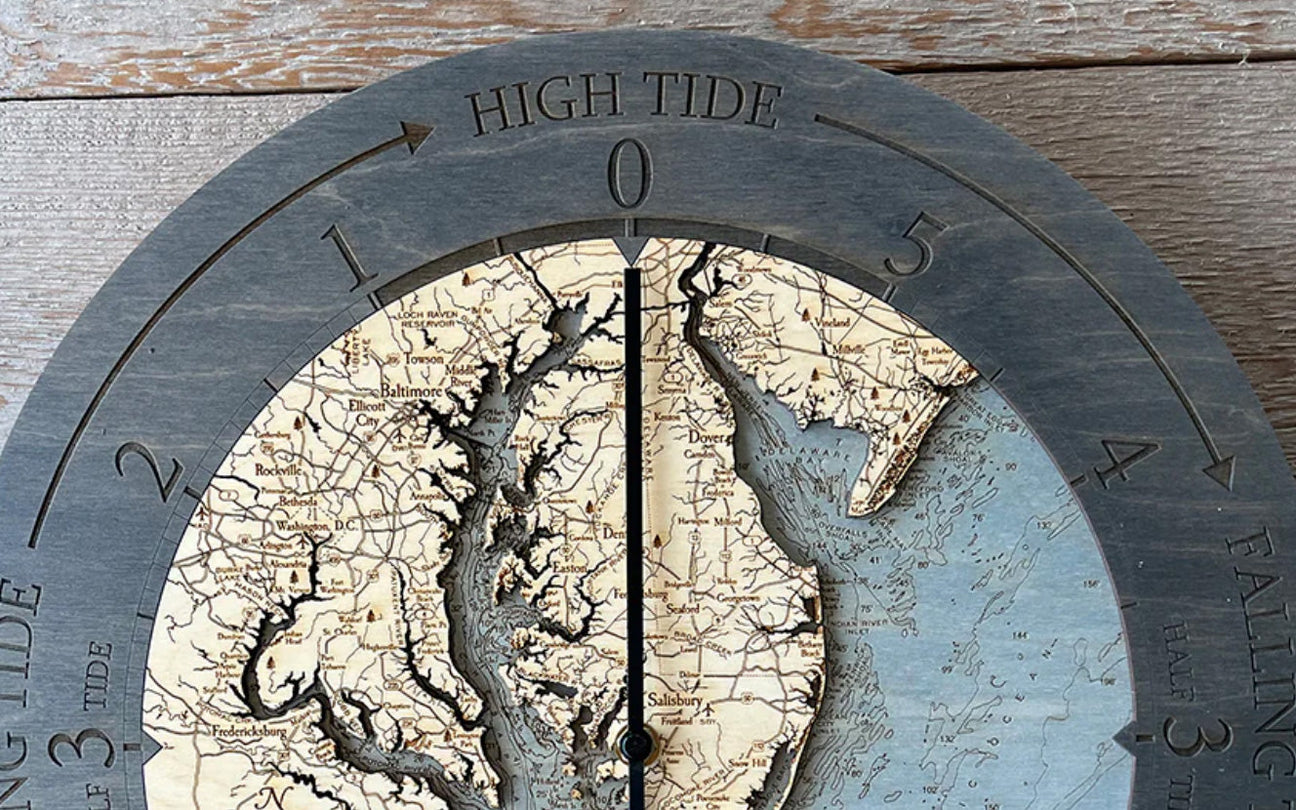
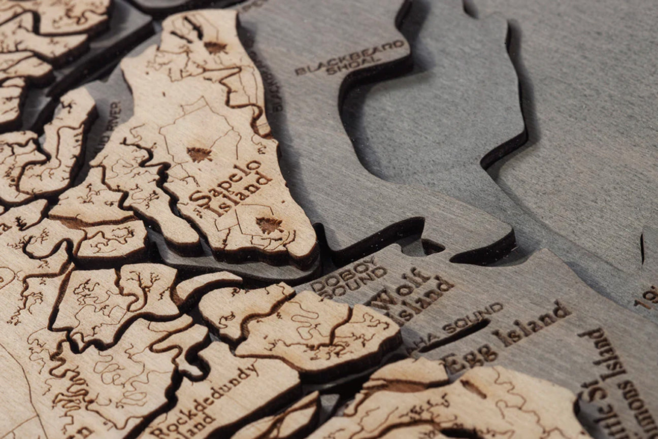
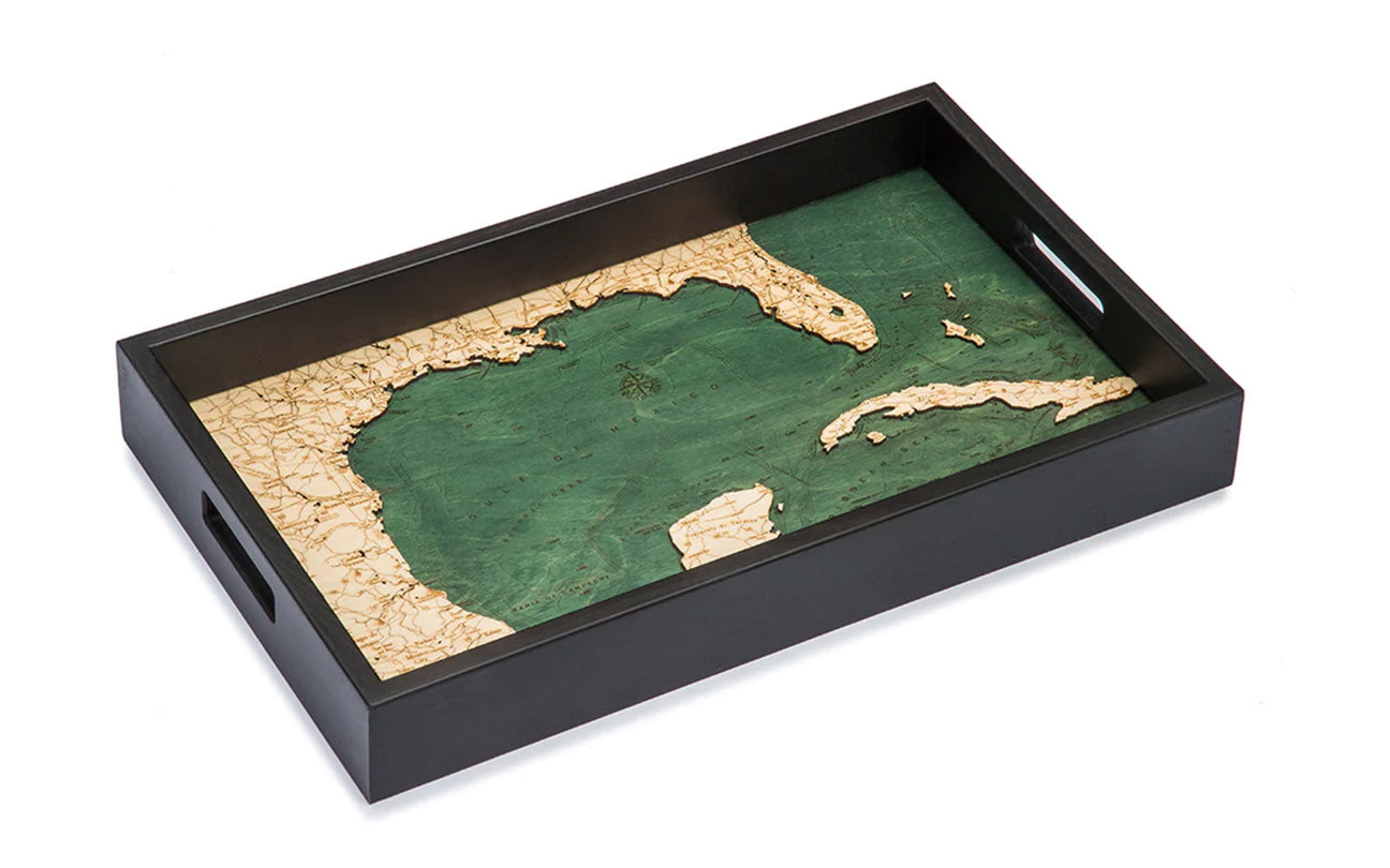
A wood map of the Great Lakes is a detailed representation of the memories the Great Lakes have created, made with high-quality Baltic wood and an obsession with the underwater topography (bathymetric chart) of the area. Wood maps can provide a beautiful piece of art to display, detailing the lake’s land and waterways, and offer a stunningly precise visual recreation of the precious places that sculpted your childhood or an unforgettable vacation. The best wood maps of the Great Lakes come in several giftable varieties.
Varieties of Giftable Wood Maps
- framed art

- wall clock
- cork map
- serving tray
- cribbage board
Remember that summer day you spent lounging with friends on the sandbar and basking by a bonfire at night? You will see it clearly in the bathymetric details of a wood map of the Great Lakes!
What is so Great About the Great Lakes?
In addition to having a memorable acronym (HOMES), the Great Lakes also make up the world’s largest freshwater system. Huron, Ontario, Michigan, Erie, and Superior make up a total surface area of 94,600 square miles. The depth and breadth of each lake are beautifully detailed on the best wood maps of the Great Lakes, showing the unique underwater terrain of each.
These vibrant waters bring life, literally and figuratively, to over thirty-five million people who live in the areas bordering the lakes. They provide drinking water, commercial benefits, and serve as a recreational oasis for those seeking outdoor adventure and sport. The lakes are genuinely amazing and rely on all of us, visitors and natives alike, to protect and preserve their beauty and cleanliness.

5 Ways to Keep the Great Lakes Great
- Watch what you wash: keep microplastics out of the water system.
- Choose a phosphorus-free fertilizer (or none at all) for your lawn and garden.
- Prevent the spread of invasive species.
- Reduce the use of and dispose of medications properly.
- Get active in political actions regarding the environment.
The Great Lakes: Deeper Than You Think

Lake Superior boasts the cleanest and clearest waters because it is not bordered by any major cities. Known for its beautiful scenery, the longer trip to Superior is entirely worth the time it takes to travel the Upper Peninsula. It is known for having the deepest spot, measuring 1,333 feet deep. For the city-slickers who may not be impressed, consider this: The Empire State Building is 1,250 feet tall and would be completely submerged at the deepest point of Lake Superior, leaving only the antenna peeking out from the depths. Wood maps provide a detailed look at the depths without having to leave your Adirondack chair on the sunny lakeshore.
Lake Huron is the second largest of the Great Lakes and offers pristine waters, gorgeous beaches, and numerous waterparks. Historic lighthouses dot the Huron landscape, and you cannot miss the picturesque sunrises from the ample shoreline. Lake Erie is the shallowest of the Great Lakes, measuring an average depth of only 62 feet. Each lake holds a magic all its own, slowly revealing its subtle wonder to each visitor and keeping a little wonder in its depths.
What Secrets Does the Water of the Great Lakes Hold?
Wood maps are not used for navigational purposes, but the detail they offer shows why the waters of the Great Lakes have historically been somewhat treacherous. The secrets of over 8,000 shipwrecks can be found in the waters of the Great Lakes, about 2,000 of which are in Lake Erie alone.

Lake Superior records about 250 shipwrecks and over 10,000 lives lost. Historical accounts vary as to exactly how many shipwrecks and lives have been lost within the Great Lakes system. Still, the underwater topography shown on wood maps can leave no doubt that they are a water system to be respected.
Another Great Lakes secret? Two million dollars in gold may or may not have been found in a Lake Michigan shipwreck. Schedule your next vacation and join treasure hunters as they explore the lakes for stolen Confederate gold, a true adventure for your up north getaway.
No matter where you are in life or the world, one look at the best wood map of the Great Lakes will take you back up north, drifting on your boat, enjoying a pop and time with your family and friends. A quality wood map can be displayed in your home, showing the beauty of the land and freshwater that make up the magical area of the Great Lakes. The pride of a Michigander is contagious. For yoopers, trolls (people from the lower peninsula), and visitors alike, taking home the best wood map of the Great Lakes will be a tell-tale sign that another heart has been lost to the Great Lakes region.