


WoodChart
Atlantic Highlands, Long Branch, Middletown, Navesink, Oceanport, Port Monmouth, Sea Bright, Shrewsbury, and West Shrewsbury
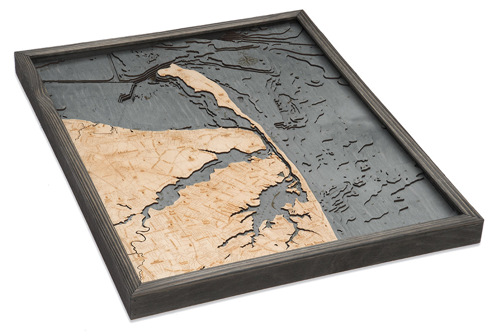
Rumson, New Jersey 3-D Nautical Wood Chart, Large, 24.5" x 31"
Regular price
$ 375.00
Shipping calculated at checkout.
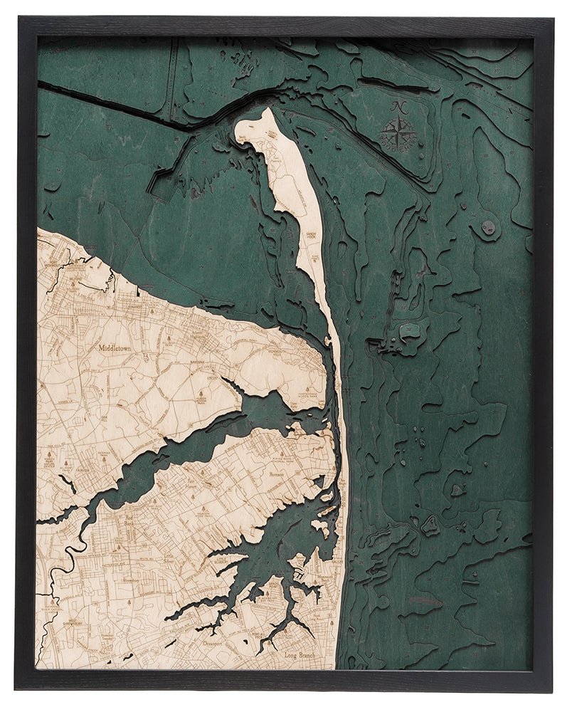
Come for the 19th century estates and stay for the scenic rides along the Navesink and Shrewsbury Rivers. Located along two rivers and the Atlantic Ocean, Rumson offers plenty of recreational activities for those wishing to summer along its shores. Boating, swimming, and lounging on the beaches remain popular pastimes for vacationers and residents alike.
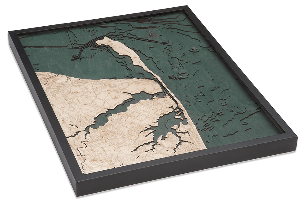
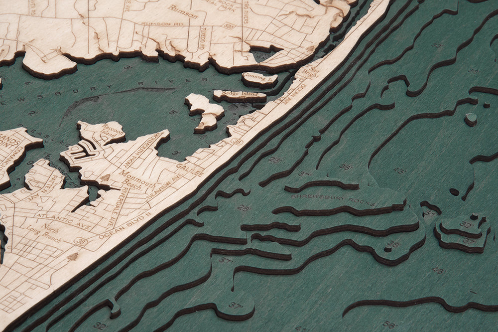
The points of interest on this wood chart stretch past Sandy Hook on the barrier island, detailing the depths of the coves and channels. Middletown and Long Branch are etched in exquisite detail, a roadmap of each city precisely reflected in the topography of the land. Your Rumson 3D wood map arrives protected with acrylic glass and ready to hang.
Points of Interest on the Rumson, New Jersey, 3D Wood Map Include:Atlantic Highlands, Long Branch, Middletown, Navesink, Oceanport, Port Monmouth, Sea Bright, Shrewsbury, and West Shrewsbury
Rumson, New Jersey Nautical Wood Chart Details:
- Made from high-quality Birch
- Solid Wood Frame Made to Fit
- Laser-cut Depth
- Engraved Names and Locations
- Acrylic Glass Protection
- Arrives Ready to Hang
Frame Styles:
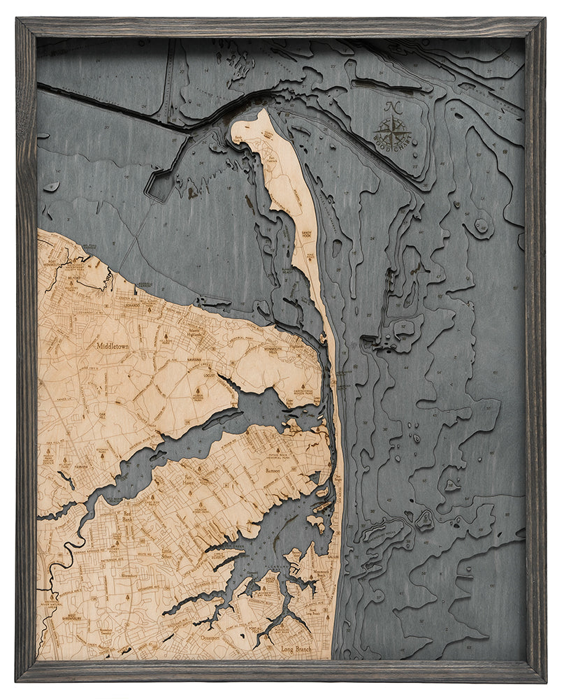
- Classic, Dark Brown Wood Frame, Greenish-Blue Water Color
- Rustic Grey Frame, Greyish-Blue Water Color