


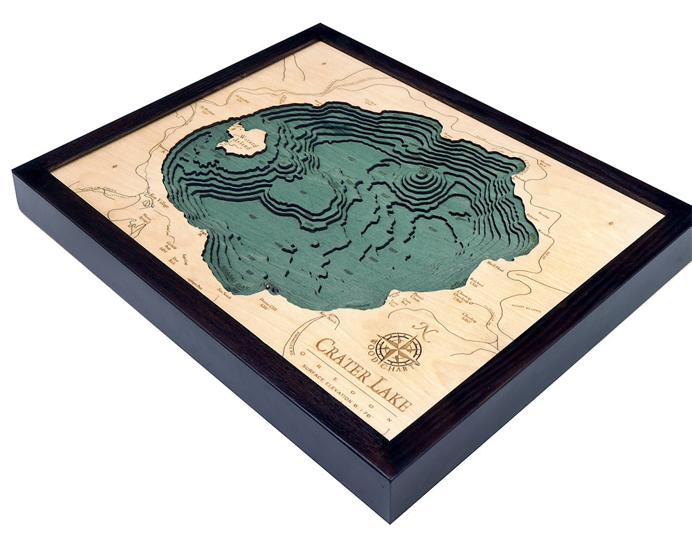

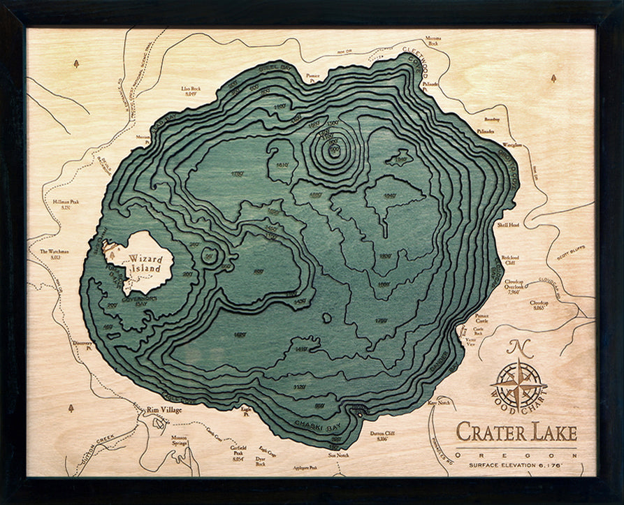

Crater Lake, Oregon 3-D Nautical Wood Chart, Small, 16" x 20"
The word magnificent doesn’t come close to doing this incredible piece of Mother Nature justice. The pristine waters and mountains surrounding Oregon’s Crater Lake provide a one-of-a-kind backdrop to everything from romantic elopements to snowshoe adventures.
Our lake art depicts the incredible topography of the deepest lake in the United States. Located in a caldera over 2,100 feet deep, Native Americans witnessed the formation of Crater Lake roughly 7,700 years ago after a volcano in Mount Mazama erupted and collapsed. Unlike traditional lakes, Crater Lake's water level is raised and lowered solely by rain, snow, and evaporation.
Our topographical lake art begins with a bathymetric chart to understand the depth of the lake’s water. A designer then creates individual laser cuttings out of high-quality birch and glues them on top of one another to showcase the dimension and beauty you see. The wood of the water is hand-stained, and points of interest are engraved into the surface of the wood. A custom wood frame and ultra-transparent piece of acrylic finish of the lake art.
Points of Interest on Oregon’s Crater Lake Map:
Wizard Island, Rim Village, Chaski Bay, Governors Bay, Scott Bluffs, and Dutton Creek
- Made of high-quality birch
- Solid wood frame made to fit
- Laser-cut depth
- Engraved names and locations
- Acrylic glass protection
- Arrives ready to hang