Beaver Island, Michigan 3-D Nautical Wood Chart, Small, 16" x 20"
Beaver Island, Michigan 3-D Nautical Wood Chart, Small, 16" x 20"
Free shipping to the continental U.S.
Couldn't load pickup availability
- Dimensions
- 16″ × 20″
- Material
- Baltic birch, hand-stained water
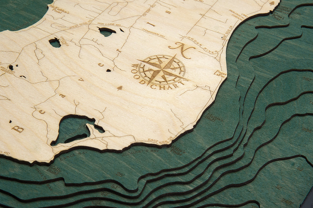
- Detail
- Carved bathymetric relief, laser-etched labels
- Source
- NOAA nautical survey data
Summers in Michigan revolve around life on the lake, and there are few better locations to relax and rejuvenate than Beaver Island, Michigan. This beautiful destination features incredible fishing, boating, and stargazing, making it a fantastic getaway for couples, families, and solo adventurers.
With a landmass of nearly sixty square miles, Beaver Island is the largest island in Lake Michigan. The area is a popular tourist destination and includes the Beaver Islands State Wildlife Research Center, pristine beaches, nature trails, and a golf course. The island is also a picturesque site for stargazing thanks to its dark night skies and expansive open views.
This nautical wood map features layers of Birch that expertly outline the area’s shorelines. An artist laser cuts pieces of wood and glues them together, hand-staining the areas depicting the lake and engraving points of interest and other important landmarks. The detail of the 3D wood map makes this piece stand out, and a custom wood frame provides a perfect finishing touch.
Display this wood chart to give yourself a daily reminder of the beauty of Beaver Island, Michigan.
Points of Interest on Beaver Island Art Wood Map:
Beaver Island, St. James, High Island, McCauley Point, Barneys Lake, Fox Lake, Greenes Lake, Lake Geneserath, Lefts Point, McFadden Point
Beaver Island Michigan Lake Art Details:
- Made of High-Grade Birch
- Solid wood frame made to fit
- Laser-cut depth
- Engraved names and locations
- Acrylic glass protection
- Arrives ready to han