
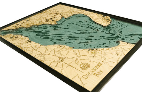
The all-important First State and Small Wonder – Delaware. The topography of this small but mighty state varies from fields to sandy beaches to swampland, each of which is finely etched into high-quality birch on our 3D wood maps. The laser-cut precision gives life to the shorelines, revealing the depths and shallows of these important bodies of water.
Each map of Delaware beaches brings to mind summers by the bay and lounging along the shores of iconic waterways. Delaware Bay has long been known as one of the most important navigational channels in the United States and every detail is intricately captured on a 3D map for you to explore and enjoy. This collection of quality Delaware shore maps offers an elegant glimpse into the waterways that built our nation, providing dimensional effects that bring each map to life.
With the detail on these wood charts, you can imagine standing on the Delaware River shore and looking across the bay to New Jersey. Each channel, harbor, and shoal are named and measured, providing a unique perspective of the mysteries of the deep. Bring the Small Wonder home to your office or gift your favorite Delaware native the historic beauty of their homeland with a nautical wood chart.