WoodChart
Santa Barbara/Channel Islands 3-D Nautical Wood Chart, Small, 16" x 20"
- Regular price
- $169.00
- Sale price
- $169.00
- Regular price
Whether you are looking for a mountain adventure or a vacation bungalow on the beach, Santa Barbara is your ideal destination. Nestled between the Santa Ynez Mountains and the Pacific Ocean, Santa Barbara offers the best of both worlds with stunning views and ample outdoor activities for either location. The Santa Barbara Channel Islands are a short, three hour boat ride away to experience both beach and forestry.
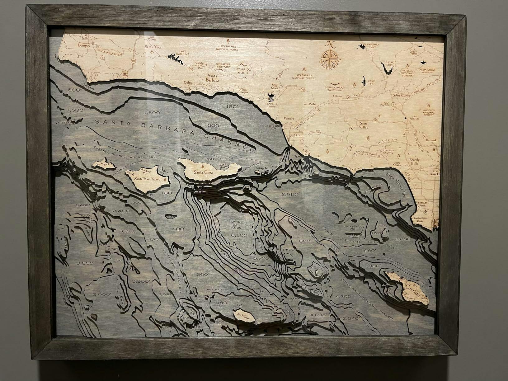
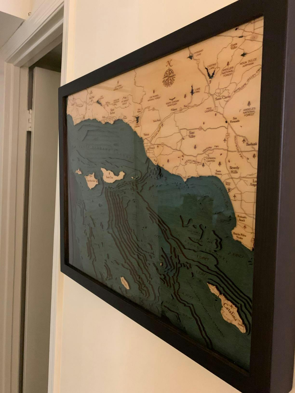
Explore the details on a 3D wood map to fully appreciate the bathymetry of these historic basins and channels. Each point of interest is clearly etched into the wood chart, providing a remarkable perspective of the laser-cut depths and shallows of the waters surrounding the Santa Barbara Channel Islands. The nautical wood map is finished in a solid wood frame, protected by acrylic glass, and arrives ready to hang.
Points of Interest on the Santa Barbara Channel Islands 3D Wood Map:
Santa Barbara, Channel Islands National Park, Santa Ynez, Santa Cruz, Santa Rosa Island, Catalina, Santa Monica Bay, Ventura, Simi Valley, and Las Padres National Forest
Santa Barbara Channel Islands Nautical Wood Map Details:
- Made with high-quality Birch
- Solid Wood Frame Made to Fit
- Details of Depth are Laser-cut
- Names and Locations Engraved
- Protected with Acrylic Glass
- Arrives Ready to Hang
Frame Styles:
- Classic, Dark Brown Frame, Greenish-Blue Water Color
- Rustic Grey Frame, Greyish-Blue Water Color