WoodChart
San Juan Islands, Washington 3-D Nautical Wood Chart, Large, 24.5" x 31"
- Regular price
- $332.00
- Sale price
- $332.00
- Regular price
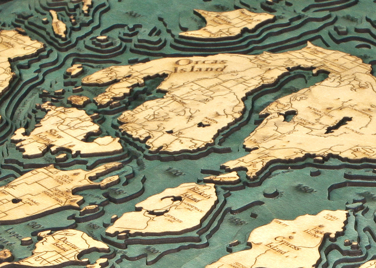
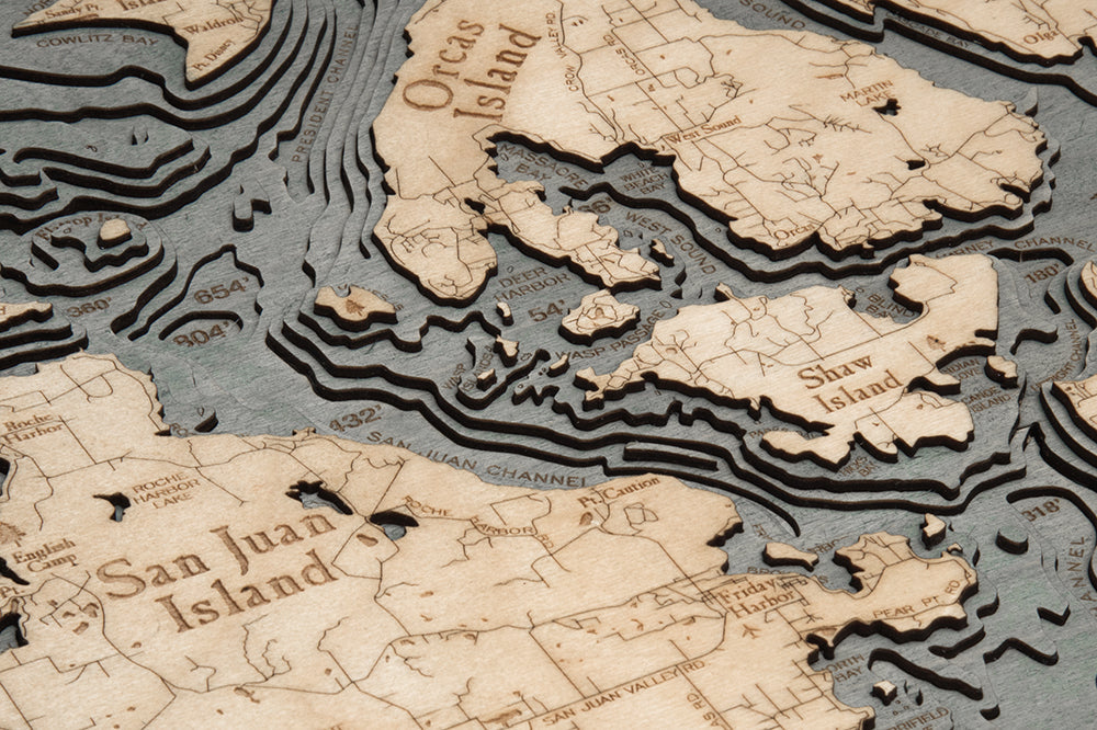
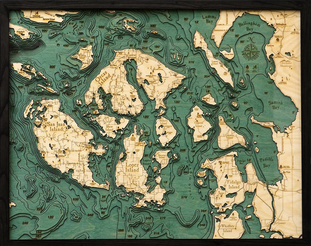
Welcome to the San Juan Islands – you are on “island time!” These islands offer beauty and recreation to all visitors, as well as a clear invitation to slow down and get mellow. Whether you choose the bustling island of San Juan or pop over to a lesser-known island you found on this nautical wood map, you will find beautiful vistas and wildlife at every turn.
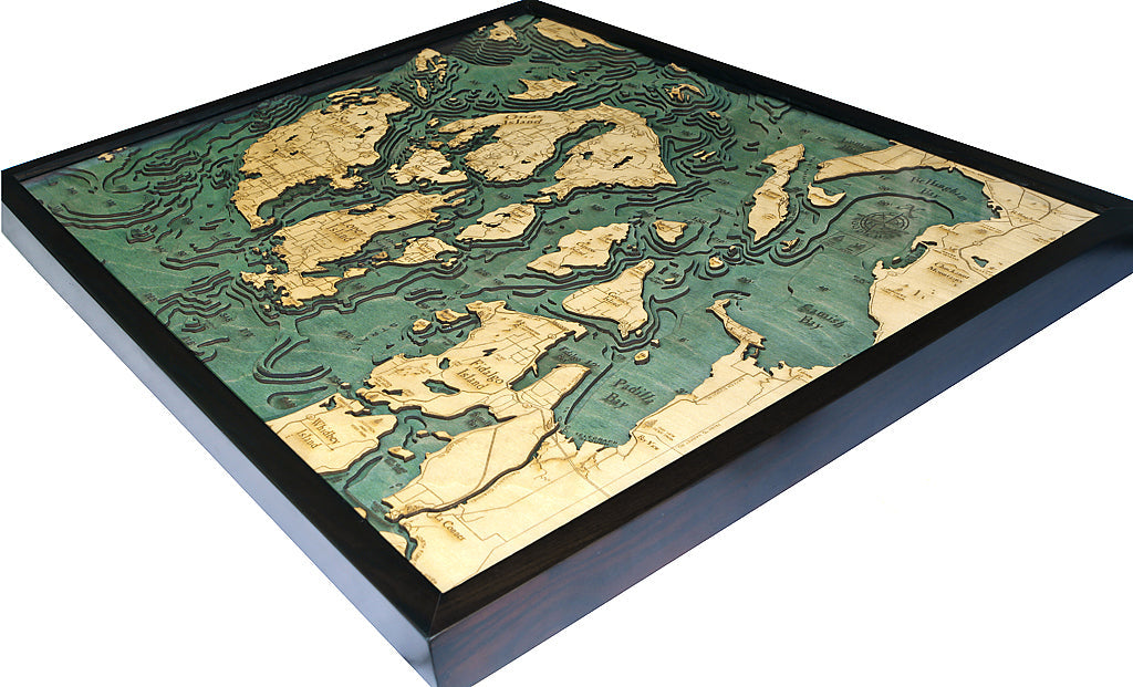
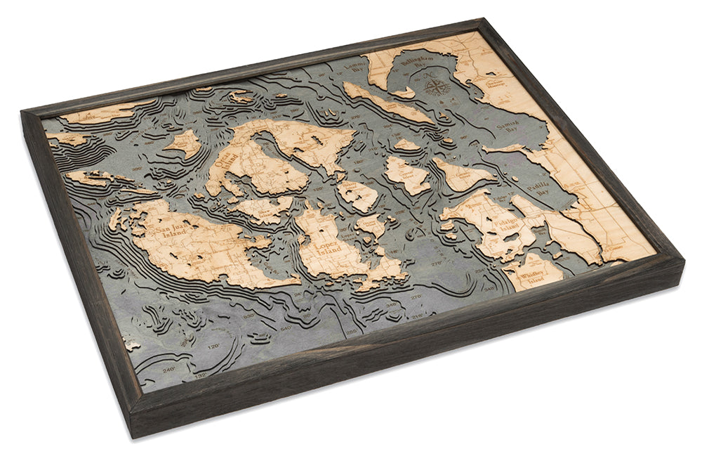
Explore the details of the San Juan Islands in the etched high-quality Birch wood chart. Find the highlighted points of interest and the bathymetry of the San Juan Islands and surrounding waterways. The 3D wood map features laser-cut pieces that are seamlessly glued together and hand-stained to create visual depths and shallows. This nautical map is then finished in a solid wood frame and protected with acrylic glass. Your wood chart arrives ready to hang.
Points of Interest on the San Juan Islands, Washington Nautical Wood Chart:
San Juan Island, Orcas Island, Lopez Island, Whidbey Island, Bellingham Bay, Lummi Bay, Boundary Pass, Padilla Bay, Samish Bay, and Fidalgo Island
San Juan Islands, Washington, Wood Map Details:
- Made with high-quality Birch
- Custom Wood Frame
- Laser-cut Depth
- Engraved Names and Locations
- Acrylic Glass Protection
- Arrives Ready to Hang
Frame Styles:
- Classic, Dark Brown Frame, Greenish-Blue Water Color
- Rustic Grey Frame, Greyish-Blue Water Color