WoodChart
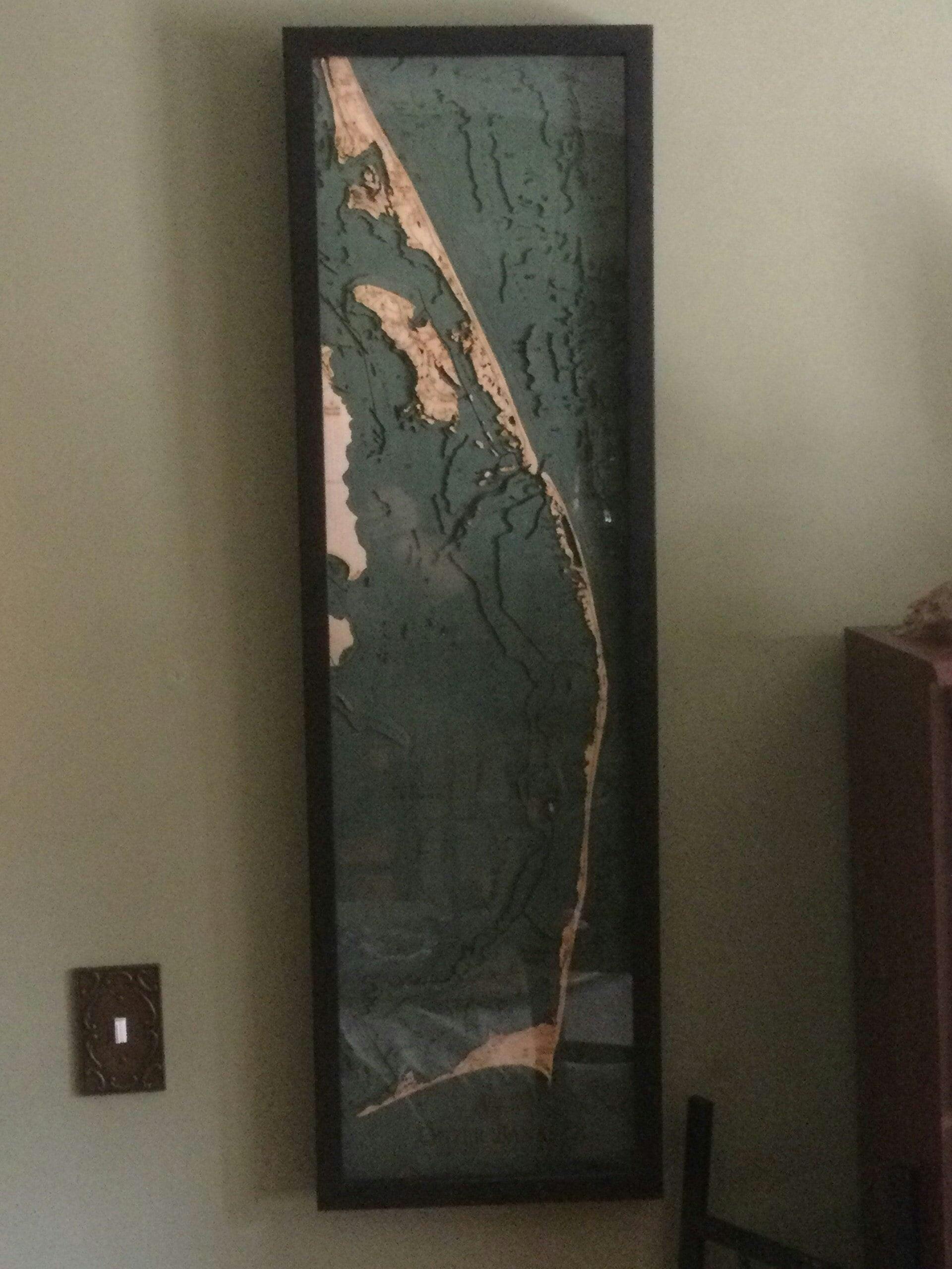
Outer Banks, North Carolina 3-D Nautical Wood Chart, Narrow, 13.5" x 43"
- Regular price
- $299.00
- Sale price
- $299.00
- Regular price
Outer Banks, North Carolina, is more than the birthplace of flight, it is the backdrop for sensational beach vacations. OBX is a barrier island off the coast of North Carolina, connected to the mainland by the Wright Brothers Bridge, detailed on this 3D wood map. Whether you crave pristine beaches, fresh seafood, or local history, Outer Banks will be everything you hoped for and more!
The Outer Banks nautical wood map displays the bathymetry of the surrounding waterways in intricate detail. The depths of the water and details of the coast are expertly etched in high-quality Birch and completed with engraved points of interest. This 3D wood map is finished with a custom frame and arrives ready to hang.
Points of Interest on the Outer Banks, North Carolina, Wood Map:
Cape Hatteras, Hatteras Island, Bodie Island, Roanoke Island, Fort Raleigh, Kitty Hawk Bay, and Kitty Hawk Pier
Outer Banks, North Carolina, Wood Map Details:
- Made of High-Grade Birch
- Solid wood frame made to fit
- Laser-cut depth
- Engraved names and locations
- Acrylic glass protection
- Arrives ready to hang
Frame Styles:
- Dark Brown Frame, Greenish Blue Water
- Rustic Grey Frame, Greyish Blue Water
- White Frame, Greyish Blue Water