WoodChart
Grand Traverse Bay 3-D Nautical Wood Chart, Small, 16" x 20"
- Regular price
- $169.00
- Sale price
- $169.00
- Regular price
Enjoy the beauty of the Grand Traverse Bay vineyards as you sip one of the region’s multiple wines. Known as the world's cherry capital and one of the best travel destinations in the country for small-town living, Traverse City is a picturesque area for romantic escapes and family adventures.
Grand Traverse Bay gets its name from eighteenth-century French explorers who crossed the bay in what they dubbed “the long crossing” or “la grande traverse.” The bay was formed by the Leelanau Peninsula and is highlighted by a historic lighthouse that marks the bay’s entrance.
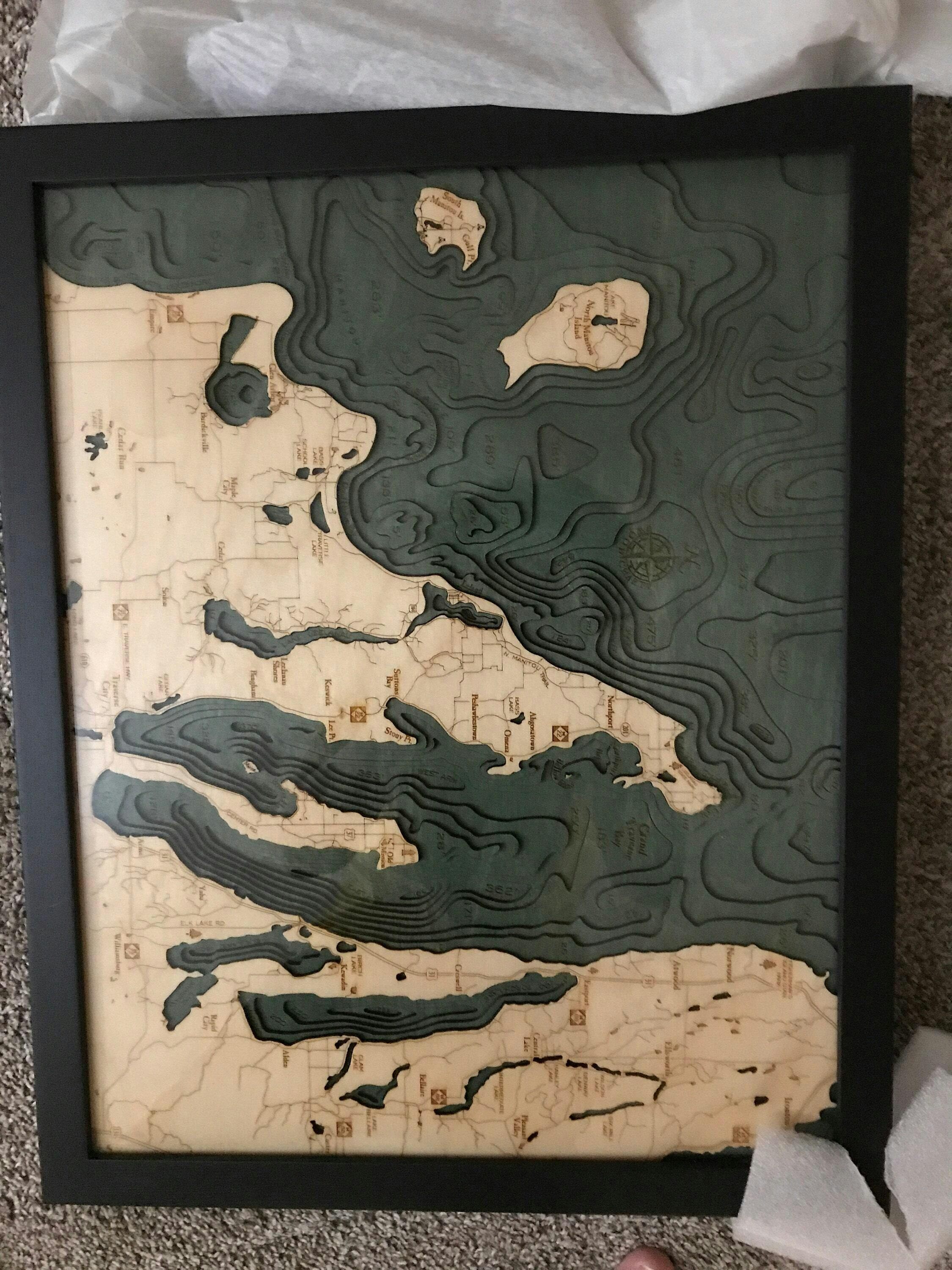
This excellent wood lake uses a bathymetric chart and high-quality birch to showcase the topography of the bay. An artist laser cuts pieces of birch into layers that depict the depths of the bay’s floor. The layers are then glued together, creating the detailed three-dimensional effect that our maps are known for. Stain is hand-applied to the water, and points of interest, roads and other locations are etched into the lake art’s surface. Each topographical map is finished with a custom wood frame and acrylic layer.
Enjoy the memories you’ve created of Grand Traverse Bay with our wood lake.
Points of Interest on Grand Traverse Map:
Leelanau State Park, The Grand Traverse Lighthouse, Northport, Old Mission Peninsula, Sleeping Bear Bay, and Traverse City
- Made of high-quality birch
- Solid wood frame made to fit
- Laser-cut depth
- Engraved names and locations
- Acrylic glass protection
- Arrives ready to hang