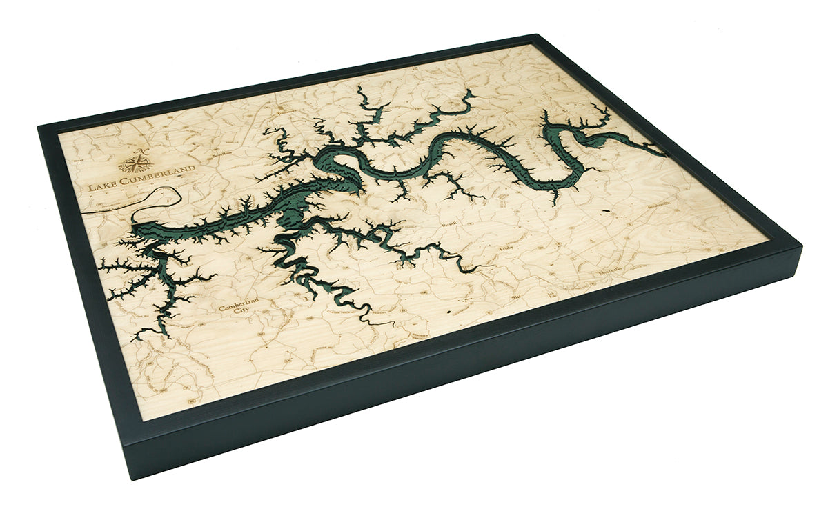
Lake Cumberland, Kentucky 3-D Nautical Wood Chart, Large, 24.5" x 31"
Lake Cumberland, Kentucky 3-D Nautical Wood Chart, Large, 24.5" x 31"
Free shipping to the continental U.S.
Couldn't load pickup availability
- Dimensions
- 24.5″ × 31″
- Material
- Baltic birch, hand-stained water
- Detail
- Carved bathymetric relief, laser-etched labels
- Source
- NOAA nautical survey data
With its long and winding shoreline, Lake Cumberland is known for its fishing, houseboats, and views of the Creelsboro Natural Arch. Whether you prefer a relaxing weekend to recharge or endless hours of flyfishing, topographical map of Kentucky’s Lake Cumberland will leave you craving your next escape.
Although the United States Army Corps of Engineers created Lake Cumberland as a reservoir to control flooding and produce hydroelectric power, the lake has become a popular vacation destination and significant source of tourism for Kentucky. It is regularly filled with houseboats that carry vacationers through the warm waters all day before they tuck into a peaceful lake cove at night.
Our topographical map of Lake Cumberland begins with a bathymetric map to determine the lake’s shorelines and water depths. An artist then laser cuts pieces of high-quality birch and glues them together to create the dimensions seen in our lake art. Next, points of interest are engraved into the map, and the water is hand-stained for added vibrancy. Finally, a custom solid wood frame provides the finishing touch to your lake art.
Inspire your next fishing adventure with topographical map of Lake Cumberland.
Points of Interest on Lake Cumberland Map:
Cumberland City, Cumberland River, Lake Cumberland State Resort Park, Jamestown, Monticello, Parnell, and Union Ridge
Lake Cumberland Lake Art Details:
- Made of high-quality birch
- Solid wood frame made to fit
- Laser-cut depth
- Engraved names and locations
- Acrylic glass protection
- Arrives ready to hang