Burt and Mullett Lake 3-D Nautical Wood Chart, Large, 24.5" x 31"
Burt and Mullett Lake 3-D Nautical Wood Chart, Large, 24.5" x 31"
Free shipping to the continental U.S.
Couldn't load pickup availability
- Dimensions
- 24.5″ × 31″
- Material
- Baltic birch, hand-stained water
- Detail
- Carved bathymetric relief, laser-etched labels
- Source
- NOAA nautical survey data
From a freshwater fishing point of view, it's hard to do better than Mullett and Burt Lakes. Enjoy a day on the water and let the fresh air blow your worries away or find adventure at one of the surrounding canopy forest tours. Whether you’re visiting with the family or competing in a cutthroat fishing tournament, you’ll find memories abound in Michigan.
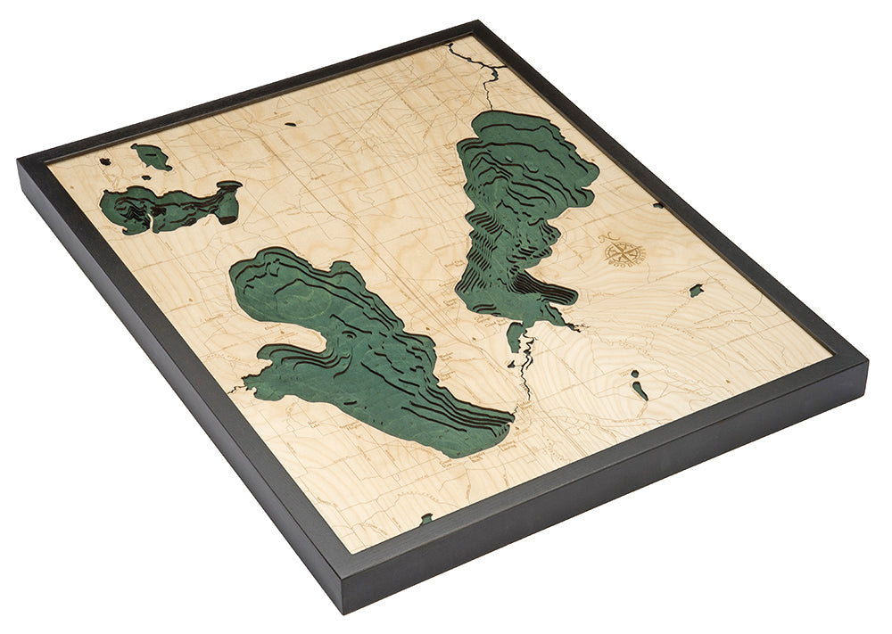
The lakes boast more than a dozen fish species and are part of the Michigan Inland Waterway, a system of lakes and rivers that originated as a Native American trade route. The lakes get their names from federal surveyors William Austin Burt and John Mullett, who originally documented the area from 1840 to 1843. Our 3D nautical wood map features a beautiful depiction of the lakes, as well as the Cheboygan River, Royal Oak Beach, and Indian River.
Each map is crafted using the utmost attention to detail to ensure the highest quality look and geographical accuracy. Once the lake art design is finalized, a laser cuts individual layers of high-quality birch wood, which are then glued together to form the topographical landscape of the wood map, and details are added by hand. Once complete, the nautical wood map is paired with a custom, solid wood frame and a durable, ultra-transparent piece of acrylic for protection.
Burt and Mullett Lake Art Details:- Made of High-Grade Birch
- Solid wood frame made to fit
- Laser-cut depth
- Engraved names and locations
- Acrylic glass protection
- Arrives ready to hang