Antigua 3-D Nautical Wood Chart, Large, 24.5" x 31"
Antigua 3-D Nautical Wood Chart, Large, 24.5" x 31"
Free shipping to the continental U.S.
Couldn't load pickup availability
- Dimensions
- 24.5″ × 31″
- Material
- Baltic birch, hand-stained water
- Detail
- Carved bathymetric relief, laser-etched labels
- Source
- NOAA nautical survey data
With the beautiful breeze and the soft sound of waves crashing around you, it’s hard to argue that the Caribbean isn’t a vacationer’s dream. The group of islands are a beloved tourist destination thanks to the gorgeous sand beaches, incredible weather throughout the year, and clear blue water.
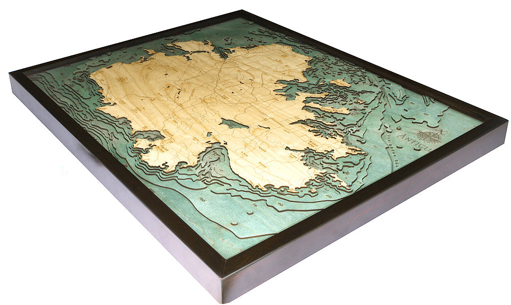
Antigua, known for being one of the sunniest islands, is in the Caribbean Sea and is the largest of the English-speaking Leeward Islands. Our 3-D nautical wood map displays the island’s incredible ocean terrain and showcases points of interest, including St. John’s, Falmouth, and English Harbour.
Each of our 3D nautical wood maps is created with the utmost attention to detail. The design begins by studying a bathymetric map to ensure each rise and fall of the ocean floor is documented within the laser-cut layers of birch that our customers know and love. The water surrounding the land is hand-stained before points of interest and landmarks are etched into the wood.
Daydream about white sand beaches and peaceful ocean waves with this beautiful 3D nautical wood map.
Points of Interest on Antigua:
St. John's, Falmouth, and English Harbour, home to the world-famous Antigua Sailing Week
Antigua Wood Map Details:
- Made of High-Grade Birch
- Solid wood frame made to fit
- Laser-cut depth
- Engraved names and locations
- Acrylic glass protection
- Arrives ready to hang